
I have extensive archives from my early storm chasing years. I chronicled almost every day on the road, even bust days, at the old SkyDiary site, with lots of photos. In the interest of collecting everything in one place, I’m moving edited journals and highlights of the older chases to ChrisKridler.com, with select photos to accompany them. Dates in the subheads are the dates of journal entries, not necessarily events.
The highlight of this account is the May 12 hail barrage and tornado at South Plains, Texas.
 May 6: Colby, Kansas
It’s been a long day, and tomorrow there’s a long drive ahead, so I’ll make this short. I drove west this afternoon from Hays to Goodland, Kansas, to get some data. My initial target was southwest Nebraska, with the thought that storms might form in eastern Colorado, just west of Goodland, and move northeast. It turns out the dryline was right there, and a few cumulus clouds were starting to bubble. The one that bubbled the most ended up being the storm I chased all day, right out of Goodland and up into Nebraska. It didn’t move fast, and despite wall clouds and a tornado warning, I didn’t see a tornado – though I did see a very well-formed scudnado (looks like one, but isn’t) that fooled me for a minute. Maybe someone in another position did see one, but the storm was rolling over a terrible road network, and I spent a lot of the day trying to pick the least muddy gravel road to traverse.
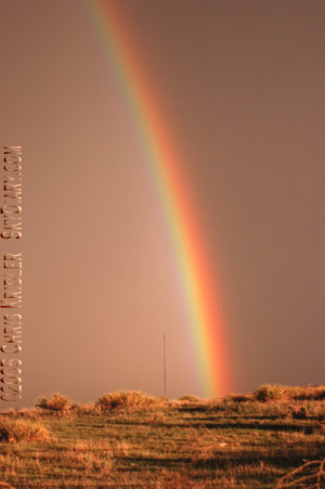
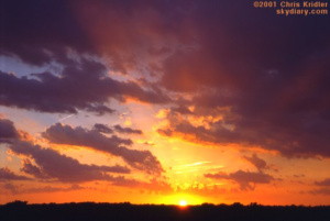
The best part of the day may have been the sunset, which shot yellow light over the rolling hills at the Kansas-Nebraska border and pulled a brilliant double rainbow out of the rain in the eastern sky, the full arch. Fantastic.
May 9: Manhattan, Kansas
It’s a quiet day in Kansas after a couple of fun storm chases. The night of May 6, I met up with the crew I chased with last year (Scott McPartland, Pete Ventre and Dave Lewison; and Mark Robinson, Dave Sills and a Toronto Star reporter), and on May 7, we set out for Kearney, Nebraska (joined by Dave Patrick and Kristy Randall of Ontario). That was our initial target, anyway.
We were almost there when storms started going off on the dryline to our west. We turned around and cruised back down the Interstate to intercept as the cells hauled north. They were pretty, even tornado-warned, but we didn’t see any tornadoes. By this time, cells were blossoming to our east, and back we went again, toward our original target in the better air, caught at one railroad crossing after another. Just west of Kearney, after another train went by, we made a right turn and saw a big, dark lowering under a tornado-warned cell. I was on the phone with hubby George at the time. “I have to call you back!” I said. We had a four-car caravan, and everyone figured we saw a tornaodo. Subsequent reviews of the tape and other reports appear to confirm it — but if you have to think about it too much, it wasn’t that great of a sighting.
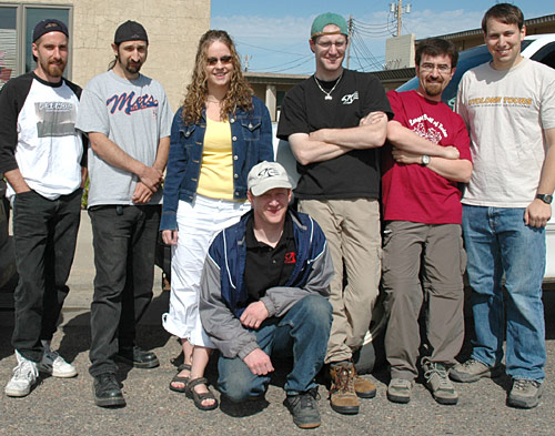
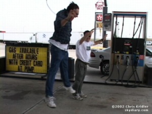
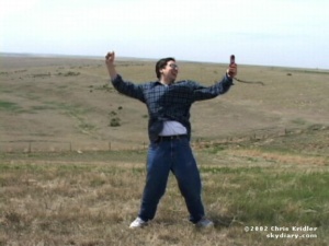
2005 chasing companions (from left): Scott McPartland, Pete Ventre, Kristy Randall and Dave Patrick, Mark Robinson, Dave Sills, Dave Lewison
The day actually got better from there. North of Grand Island, there was redevelopment on the back end of the storm, and we caught some pretty towers going up with scudding clouds in the inflow that the inexperienced might call a funnel. Meanwhile, there were plenty of the inexperienced around. All the locals were out for a chase. While we were filming the cell, a guy in a truck stopped in the middle of the road to tell us he’d just filmed a 20-minute tornado.
“Want to see it?” he said. “Not right now,” we told him. Um, we’re kinda busy, you know? Meanwhile, Mark Robinson’s car is a magnet for yahoos. It’s got about a zillion antennas, an anemometer, flashing lights, glaring decals. Scott McPartland’s car isn’t quite as obvious, but it also has a lot of gear on the roof and decals, along with a hail shield that Dave Lewison helped him build. Dave Patrick’s truck also has gear and a big lightning picture in the back window. So cars were following us all day … even into the network of muddy farm roads we then entered.
The roads were gravel and dirt, not too bad before it rained. But cells were passing through the area, including the ones we were chasing. We stopped on a hill and filmed a pretty orange sunset and a cell carved out by a rear-flank downdraft. Again, no tornado. I guess it was boring for the tagalongs as we hung out and took pictures, so they took off. I suggested we get moving before it got dark, because my Honda Element wasn’t thrilled with the roads.
As we got going, dusk was falling, and a new line of storms was headed for us. I noticed a young man walking along the road. He had a desperate expression and appeared to try to flag me down. I radioed Mark, who said they’d seen him, too. We decided to stop and see if we could help.
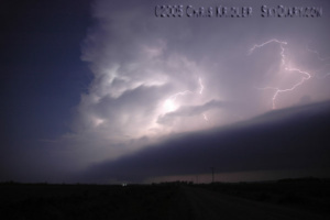
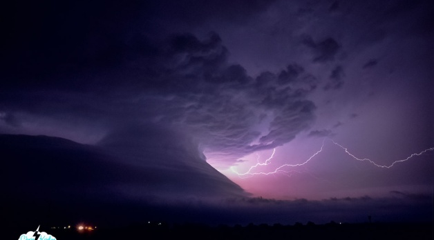
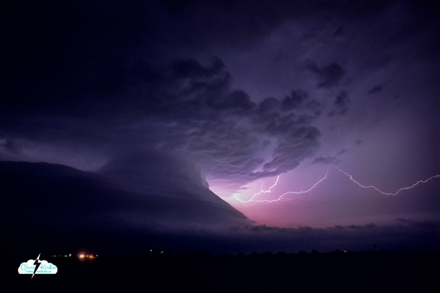
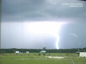
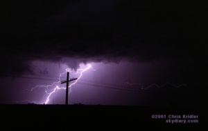
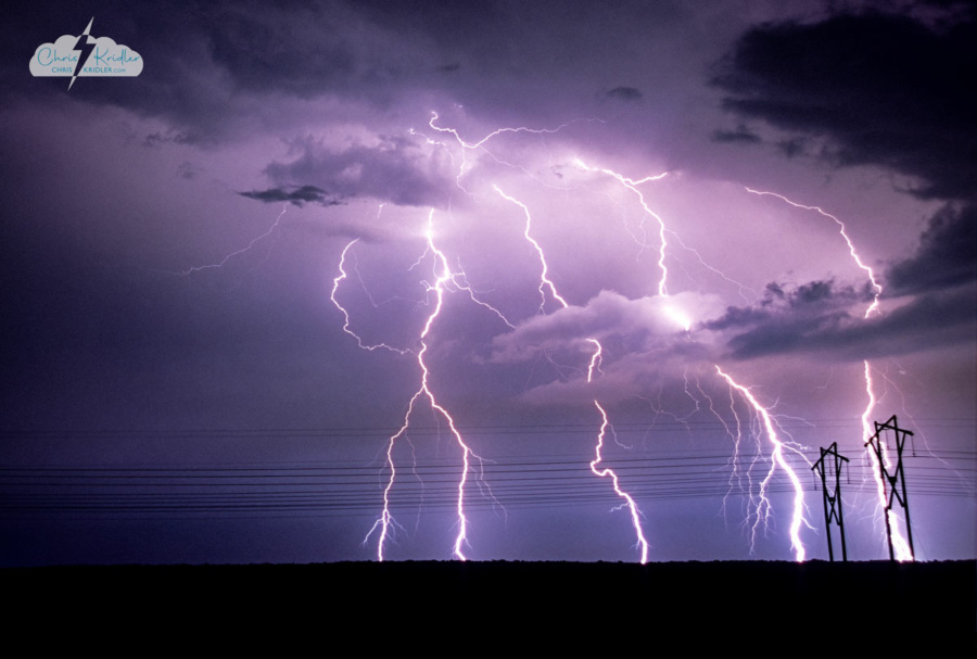
Lightning May 7.
May I just say, “Duh.” This was a carload of Grand Island locals, five young guys, who said they were following the storm and got lost. No, they were following US and got lost – and then slid their car into a ditch. We couldn’t even drive down the road they went down. A few of our guys walked into the lowering darkness to see if they could help push it out. They tried, unsuccessfully, while the cells got closer. Dave L.’s WxWorx satellite data showed “shear markers” in the storms, signs of rotation.
“We have to go NOW!” half our crew was shouting to the other half, who were down the hill in the dark, trying to get the car out. We ended up rearranging our passengers and carrying the five guys to the nearest town, Fullerton. Their car was left behind. Wicked storms trained over that area all evening … the car was probably door-deep in mud by the time it was over. We didn’t go back to find out.
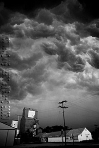
Ominous “whale’s mouth” over Frankfort, Kansas, May 8.
South of Fullerton, we stopped and enjoyed a fantastic, strobing lightning show from the line of storms. It was like flash bulbs constantly going off, little sparks shooting through the clouds. We took lots of pictures and video, including shots of each other in front of the light show, a prairie Vegas.
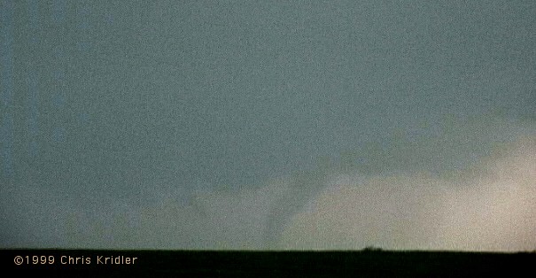
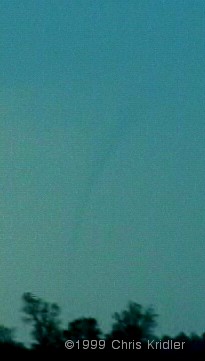
May 8, we started out in Grand Island and headed east and south. We saw lots of storms, but nothing significant, except for a brief, well-formed funnel south of Washington, Kansas.
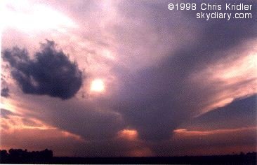
When it all merged into a fast-moving line, we got ahead enough to enjoy the “whale’s mouth” appearance, a roiling cathedral ceiling tumbling over itself, glowing with blue light. Then, for once, we had a relatively early night and grazed at the Sirloin Stockade in Manhattan, Kansas, for dinner.
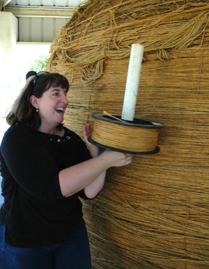
Things should pick up tomorrow and might be really interesting Wednesday. It’s a matter of powerful dynamics coming together in a favorable way. Today, well, we might go see that crazy big ball of twine again.
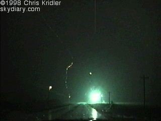
“It sounded like a freight train” – Nebraska, May 10, 2005
May 13: Amarillo, Texas
Amarillo, Texas, is where I’m holed up while Band-Aids are put on my car after a good thrashing by hail yesterday (May 12). But let me backtrack a bit.
I was going to tell you about our stop in Cawker City, Kansas, a few days ago, when we actually got to add twine to the world’s largest ball of twine. Yes, the twine I added is now part of history, and I was pretty giddy with the excitement! And then I was going to tell you about a couple of subsequent chases … a powerful supercell in Nebraska that came painfully close to producing a tornado, but was mostly a fest of dusty spinups before becoming a stacked-plate behemoth after dark; and a frustrating Kansas chase that left us behind the storms in Nebraska and too far ahead of them in southwest Kansas – a day redeemed only by some nice lightning.
But instead of going on about all that, I’ll tell you about May 12.
Highway to hail, 2005 edition
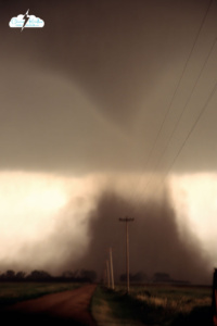
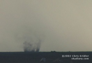
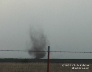
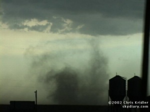
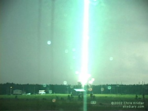
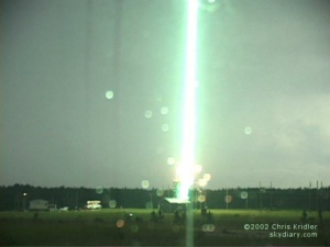
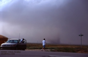
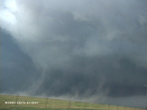
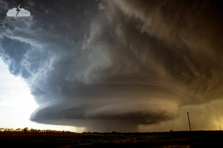
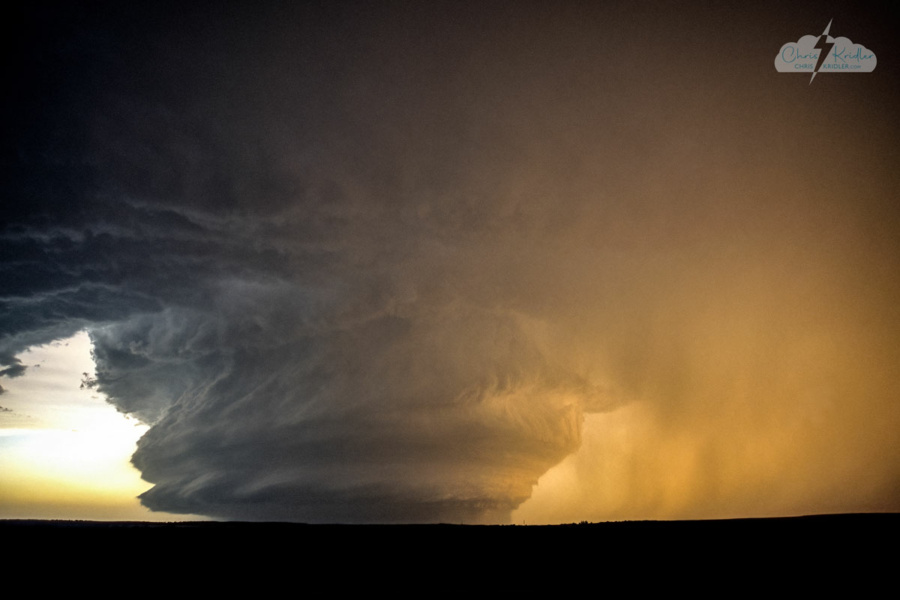
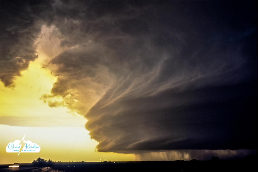
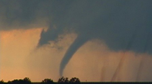
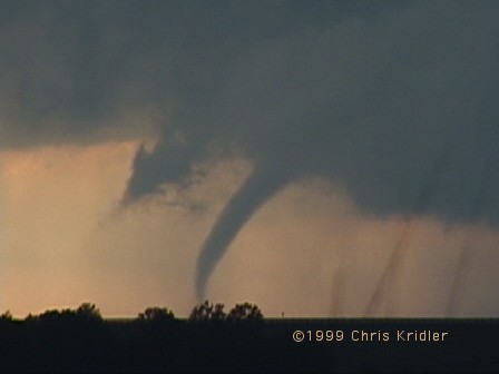
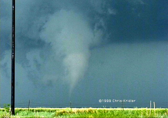
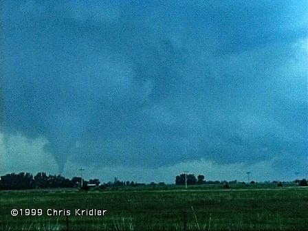
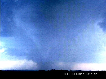
The May 12 South Plains tornado and hail barrage
May 12 is turning out to be a pretty significant day for me. Last year, I was with Dave Lewison, Scott McPartland and Pete Ventre that day, just east of the house destroyed by a tornado in Attica, Kansas. This year, I was with them, and Dave Patrick and Kristy Randall, in the Texas panhandle when everything went crazy. (Mark Robinson and Dave Sills had decided to chase in Kansas on their way home to Ontario.)
We started the day in Garden City, Kansas (where I stayed in the Best Western’s Presidential Suite for the single rate – Jacuzzi and everything!), and even though we knew we had what could be an impossible drive ahead of us, we decided Lubbock, Texas, was a good target. If anything went up along the front along the way, we could consider going after it.
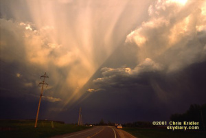
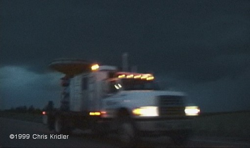
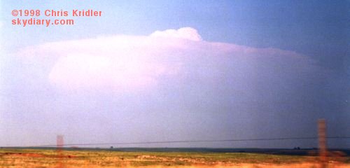
It’s almost a magical feeling, coming out from under the cold side of a weather front. Most of us don’t think about that kind of thing in our everyday lives, but when you know that there’s a boundary between two air masses, and you drive hundreds of miles to get from one side to the other, you’re very conscious of the vast changes going on around you. First, it was cloudy and cold, then eerily foggy. Then, it was suddenly warmer, with clearer skies above, and we saw the anvil of a tasty storm coming out of Plainview. Dave L. was able to track its growth using the WxWorx system that draws radar data from the XM satellites.
At a gas station, we ran into Tim Samaras and his pumped-up truck, loaded with off-road gear from a corporate sponsor. Some of you might have seen Tim featured on “National Geographic.” He’s a very nice guy. We said hello, and he told us to be careful. I think of that with irony now. (Of course, Tim deploys probes in the paths of tornadoes.)
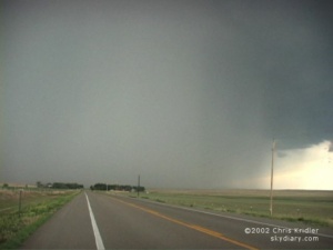
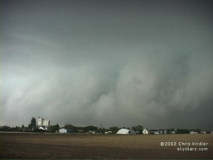
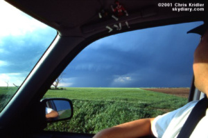
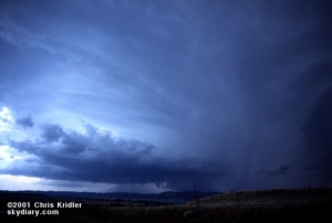
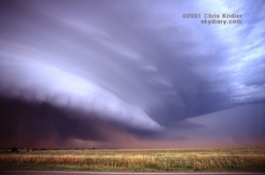
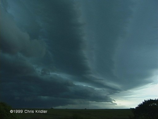
So we got into the Panhandle, into the blocky, hilly geography of the Caprock, then west into the flatter areas of Quitaque and Silverton, and went south on 207. The first storm looked pretty good, and it formed a spinning wall cloud and rear-flank downdraft and looked like it was about to produce a tornado. It didn’t, but it was dropping baseball-size hail on chasers who tried to get north of it.
We decided to chase the southern storm, which looked promising visually and on radar. It followed about the same path. We went down a muddy farm road a little ways, but not far enough to get into trouble, and watched it evolve. This one’s downdraft kicked up dust, including distinct tornado-like spinups, and its wall cloud had some serious rotation. Our party was separated by a short distance on the farm road, but we all headed out toward the paved north-south road at about the same time to stay ahead of it.
As I started to drive south a bit farther, hoping to get south of it, it began to form a funnel.
Like almost everyone else – and there were a lot of chasers around, including tour groups – I pulled off to get some video and pictures. I realized there was big hail somewhere in there, but I also realized that I didn’t want to cross the road in front of it. There are a lot of “ifs” you consider later – if I’d kept going, I might have avoided the big hail, though I’d have no tornado video. Or if I’d kept going, I might have been munched by a huge tornado. In all, taking chances with the hail is probably smarter, though not much. (I suppose staying home is smartest.)
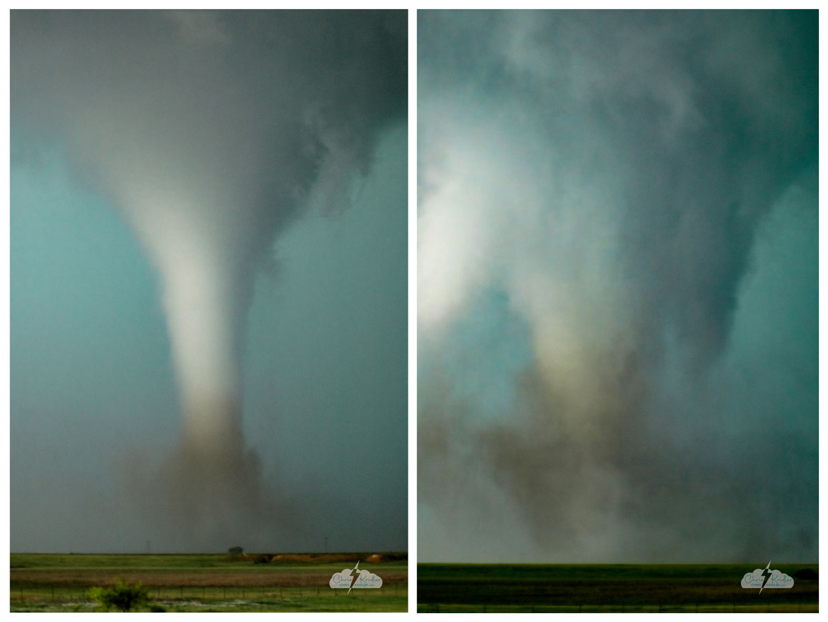
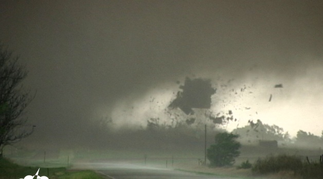
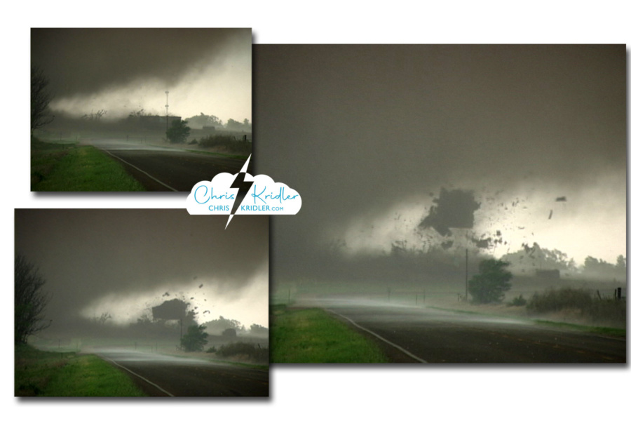
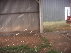
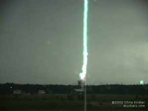
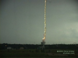
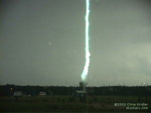
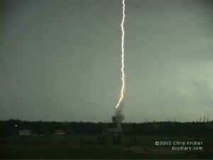
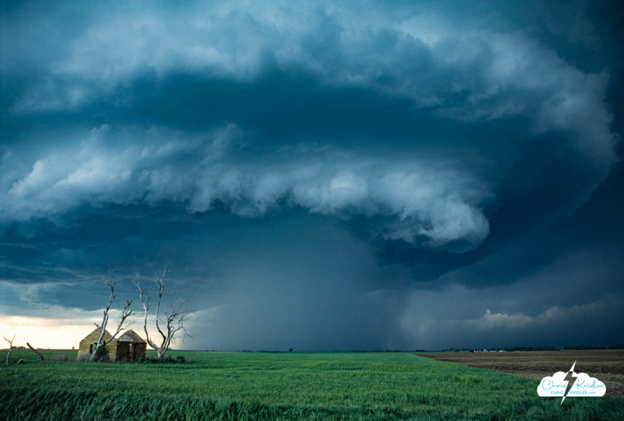
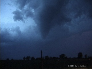
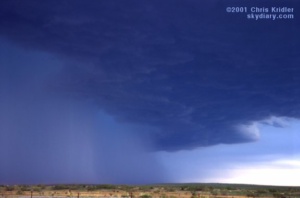
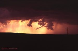
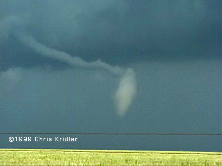
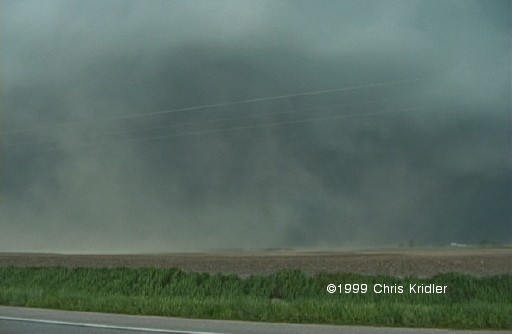
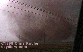
The South Plains (or Lone Star) tornado in two stages of its evolution, May 12, 2005.
Anyway, the tornado formed a beautiful white cone with a brown debris cloud flying around its base. It thickened, with condensation swirling in spirals around it, then darkened and grew as it got closer to the road.
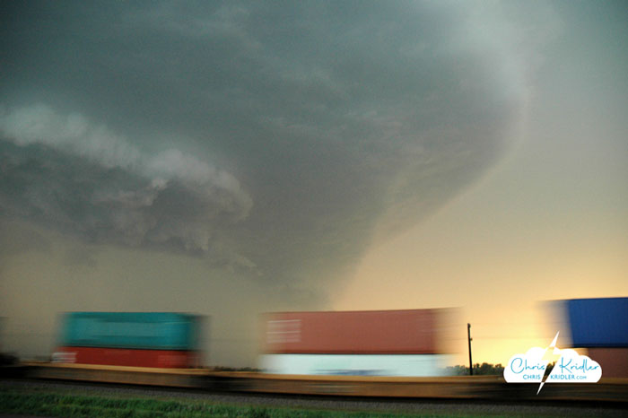
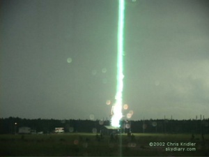
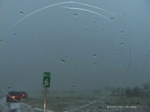
The tornado crosses the road south of my location.
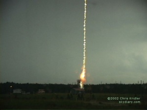
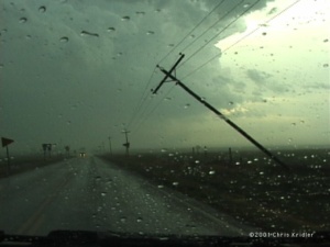
It crossed, with a huge, dusty circulation under the dark cylinder of the tornado. Dave L. warned over the radio from Scott’s car that we had to get out of there to avoid the big hail. But there was a big problem: The tornado had felled power poles, which were lying across the road. There might have been a way to squeak around, but by then we were in serious wind, rain and hail on the outer edges of the circulation, and then the big stuff started falling.)
This was one of those “lie back and think of England” moments, when you just have to resign yourself to the ravishing to follow. It’s like what they say about people on airplanes who know they’re going to crash – they don’t generally panic. And I had been through something like this before, in 2001. I naively thought this couldn’t get much worse.
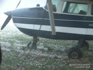
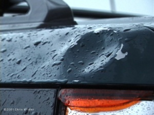
It was. In 2001, my CR-V was hit by mostly golf balls and a few baseballs. This was mostly baseballs and a few softballs and grapefruits. It sounded like bowling balls were slamming into my roof. With some of those impacts, the entire car shook and the covers on my ceiling lights actually fell off. I was starting to worry that stones were going to come through.
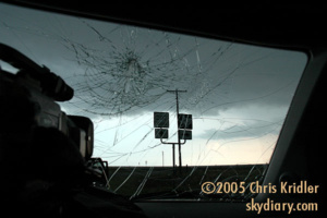
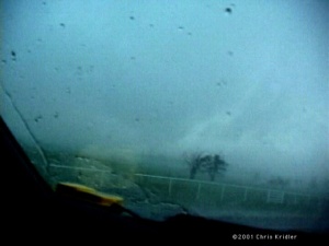
Hail shattered the Element’s windshield, among other things.
My windshield was whacked multiple times, with each impact creating a spectacular spider-web smash. A few little bits of glass fell onto the dash, but it held. Then I noticed I was getting hit by tiny bits of hail and rain. I couldn’t figure it out. Then I looked back. The side window in the back on my side was smashed in. I climbed back and stuffed a pillow in the hole to keep the worst of the stuff out. When the worst seemed to be over, we picked our way around the fallen power poles and headed south to get out of the precipitation and assess the damage. (And my pillow was lost along the way. I loved that pillow.)
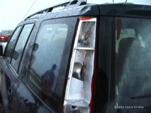
So, in brief, the damage was … the two windows; a smashed-out taillight; huge dents that look like the product of a beating with a baseball bat; cracked plastic here and there; and my wounded psyche. At least that metal hail shield I’d ordered built for the sunroof was rock-solid. I can’t even imagine being in a storm like that with an unprotected glass sunroof. My car really would have been a hail-catcher (I talk about turning it into one sometimes; I’d have to armor it first).
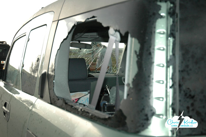
A side window blown out by hail.
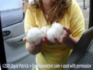
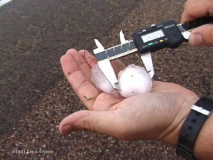
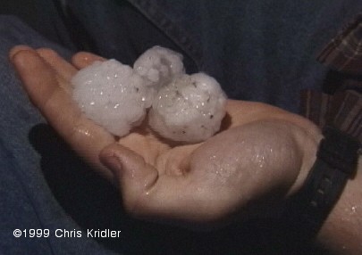
Kristy and Dave P. sampled the hailstones that got us.
One of Scott’s hail shields flew off. He had them for every window, but he lost a side window because he lost the shield. The chicken-wire hail shield he and Dave L. built to hang over the windshield preserved the window but had huge, bowl-like indentations in it from the hail strikes. Scott’s car also had body damage. So did Dave Patrick’s truck, and his windshield was hosed, too.
A lot of other chasers were caught. We ran into Cloud 9 Tours afterward. One of their side windows was blown out.
“Was there screaming in the van?” I asked.
“I was screaming,” a tourist from Liverpool said.
I don’t blame him.
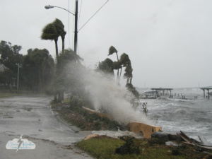


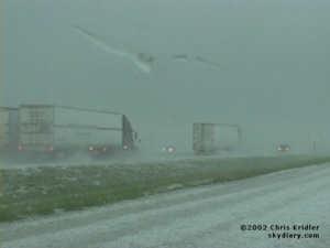
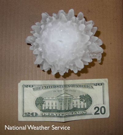 Our priority became getting out of the path. We also had to navigate out of the hail, so we headed east out of Harper. Check out this NWS photo of 5.24-inch hail from this storm!


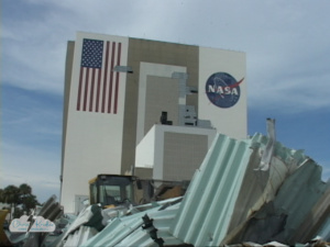
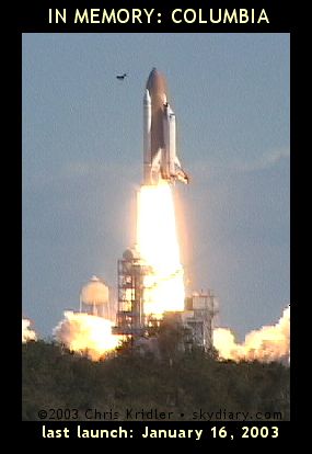 With the destruction of space shuttle Columbia on Feb. 1, my work life became a kind of hell. I was a space reporter for Florida Today, one of three. I covered the mission from Kennedy Space Center while the shuttle was still in orbit and before. I had interviewed the astronauts multiple times. I cared about the astronauts before the accident – most reporters didn’t even know their names. What followed was not only a sense of trauma and personal loss but an intense work schedule that involved countless hours, a trip to Houston, and, later in the spring, a trip overseas.
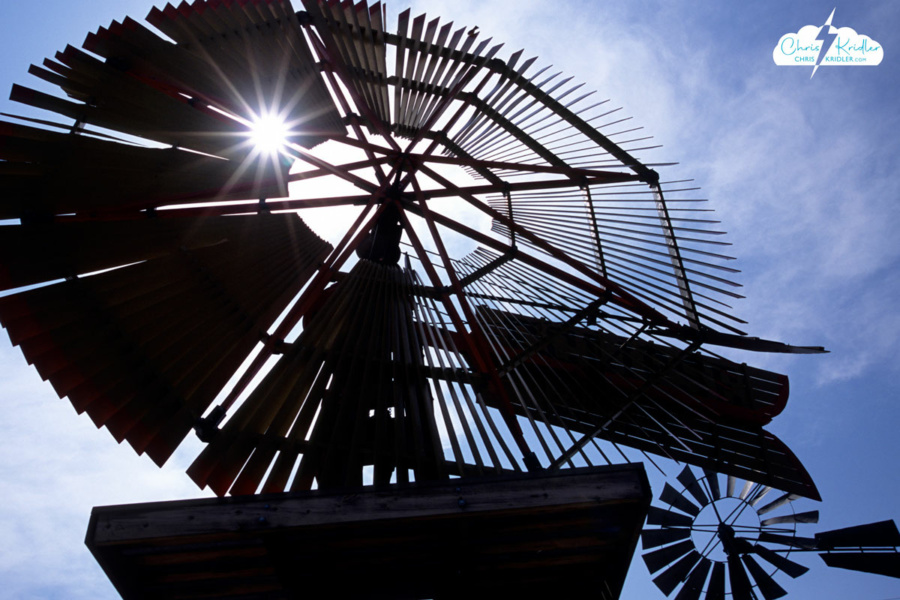
 On our way to the border, we stopped in Shattuck, Okla., where a mesmerizing park sprouts a number of old-time windmills, in a variety of designs. Every time the wind blows, there’s a haunting creaking and whispering from these beautiful mechanical trees, giant metal flowers that tower above the colorful wildflowers at their feet.
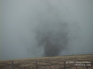
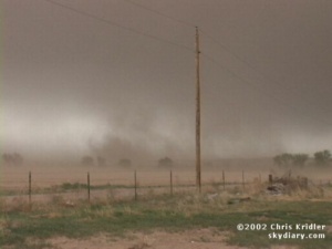
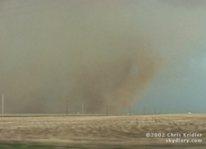 e were feeling cold outflow winds the whole time, and then, briefly, we got warm inflow, the sign that at least one part of the storm was still trying to stay alive by pulling in warm air from the east. About that time, a huge gustnado – could it have been a tornado? – spun up red dust in the field right next to us. The dust churned and rose, almost in a tube shape, to the edge of the storm clouds.
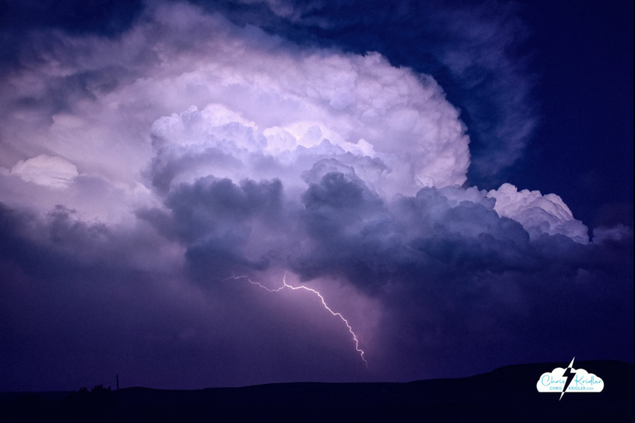
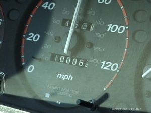 I last wrote on May 15. On May 16, we chased with George in Kansas, but didn’t see much … just some mushy storms and a few lightning bolts. And my car’s odometer turned over 100,000 miles somewhere near Liberal, Kansas.
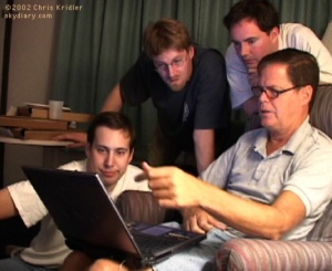
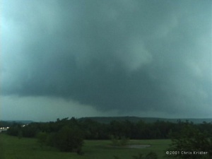 After a brief lightning show at our hotel in Denison, Texas, we got a little sleep and got psyched for Sunday, May 20. The Storm Prediction Center’s discussions of the day’s potential included all kinds of signs of doom, and the other data seemed to bear out the potential for tornadoes. We hovered on the Texas-Oklahoma border at a truck stop, checking data on the laptop, then headed into Oklahoma to Atoka in the early afternoon to get nearer to where the action was, in the PDS tornado watch box – or “particularly dangerous situation.” A quick Internet radar check revealed a couple of storms had already gone up north of us, on the boundary. We started heading that way.
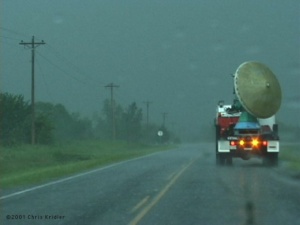 Ahead of us on Route 75 were two Doppler on Wheels trucks. We took this as a good sign, but the circumstances were not good. Chasing in eastern Oklahoma is challenging, to say the least. There are massive hills and lots of trees. It’s very difficult to see storm structure. And rain makes it even worse, and boy, did we get rain – but not yet.
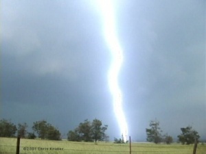
 Certainly, we were in a tornadic circulation, if not just south of a tornado, and my adrenaline was high. It’s the first time I ever felt truly in danger from a storm. In town, the sirens were screaming. Some guy was poking along ahead of me as if he was out shopping for flowers. I flashed my lights and he moved over. At a red light, I stopped, made sure no cars were coming, then went through with my blinkers on. Dave was aghast. I said, “It’s a #&%*$ tornado, Dave, I’m running the red light!” As we pushed through town, rain curtains ahead of us were clearly rushing from right to left, wrapping around the area of rotation. We were in the “bear’s cage,” no doubt about it.
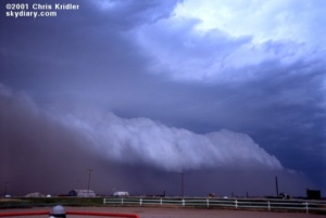
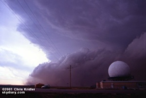 May 27 was a blast, or, you might say, a sandblast. Dave, Bill and I met up with Steve Sponsler and headed up into Kansas. We had hopes for supercells, but most storms were going up early and beginning to merge in a messy line. At a truck stop in Sublette, we looked at radar images and weighed our options as the sky outside became more and more ominous. By the time we headed north, it was too late to get individual cells … the whole mess had merged into a great line, a dramatic shelf cloud rolling toward us, kicking up brown dirt underneath it as it went. We stopped by a radar dome and got video and stills as it approached. Then the first dust hit. It was a haboob, a Dust Bowl storm, a roaring animal.
 Upslope storms – the kind that form on the higher elevations near the mountains – seemed the best bet for May 28. The phones were out in the hotel, which was a very plush Super 8, I might add, so we got the basics on the day’s outlook from Jay Antle and began meandering west. We met up with Ed Roberts from Kansas City and some other chasers in Guymon, Oklahoma, who kindly shared some data files they’d pulled, and we headed farther west. In Dalhart, Texas, a nice woman at the Holiday Inn Express let us plug in for a few minutes to get more information, and we headed for Clayton, New Mexico. If you’re counting, that’s three states already.
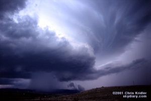
 Last Thursday, Dave and I targeted northeast Iowa. Low pressure was moving into the area, which would cause the surface winds to come from the south or southeast, while upper-level winds were streaming in from the west. The result: shear in the atmosphere, meaning if a storm went up — and it was likely where the warm and cold fronts met — it would probably rotate.
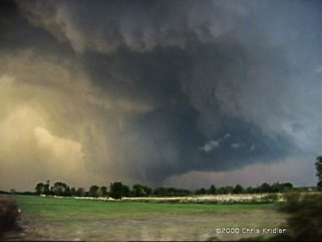
 Going backwards in time to May 16 — the day before — we played what seemed iffy chances for supercells in western Nebraska. We thought the action would be in extreme western Nebraska or even eastern Wyoming, especially after checking data and running into chasers Keith Brown and David Fogel (again in Ogallala). As we zoomed west, it became clear that this was going to be a major chaser convergence. Translated: A circus of idiot drivers. Now, obviously, I don’t think all chasers are irresponsible, but there are definitely chasers who are giving the rest of us a bad name. They are also becoming incredibly ostentatious, with loads of silly equipment on their roofs, including (in my opinion) useless marine radar units. What, are they going boating in their Ford Expeditions?
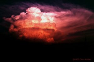 We saw the storm from when it was a pup, a little towering cumulus. It exploded and soon became a big bad dog — isolated. Huge. Multiple overshooting tops. But it was SCREAMING southeast, way ahead of us. It zoomed into Arkansas (Richard left us in mid-chase because of the hopelessness of the pursuit), and we had to listen to hail reports and spotter-reported tornado warning(s) as we tried to pursue it. We ended up in Arkansas, just east of Fort Smith, with a photogenic bomb that formed on its backside — very pretty, though it croaked at sunset. We met David O. Stillings, the Lightning Stalker (that’s just how he introduces himself, too, at rat-a-tat speed) and Jason Persoff, both Florida chasers traveling with a Pioneer Productions TV crew, as well as a couple of Arkansas chasers — Jason Politte and Scott Blair. We’re all part of a strange, little mobile community that keeps meeting on the grassy banks of farm roads in the middle of nowhere.


 I nearly gave up hope when I saw the tattered remains of a big storm, but I soon realized that several more were building. I headed further west toward one of them, and soon the radio station I was listening to was citing a Doppler-indicated tornado warning. But by the time I got near the storm, the warning had expired. Still, the lightning was amazing, and it was clear that major action was occurring, as I noticed another big “anvil” (blown off the top of a storm) to my south.
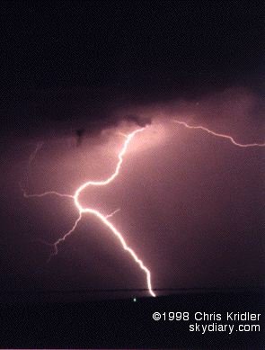
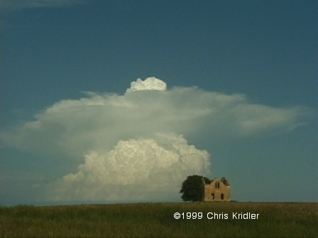
 The storm was a loner. That’s an encouraging thing, because no other storms were around to steal its energy (or steal its thunder). It was feeding greedily off the heat and moisture that had been building in the atmosphere and was soon a big fist sticking up. Then it mushroomed, growing in mass and spitting out a big circular anvil at its crest. An overshooting top showed a strong updraft. This was a monster in the making.
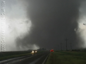
 Though it wasn’t particularly strong, it was dramatic — it spun up a big bowl of dust just north of the road and soon was writhing with dark reddish-brown tendrils. It looked as if it was going to cross the road just east of us. Everything was happening very quickly. And then the wind knocked over a telephone pole about 25 yards in front of us and the tornado turned south-southwest — headed right for us. We were in the “bear’s cage.” The other tour van, which was east of the tornado, zoomed east away from the twister as it got within a hundred yards of us, making our big van shudder with strong winds. We got turned around, briefly spun our wheels in the slope off the road and sped west away from it. It was thrilling. It soon crossed the road, weakened and died. Another small tornado spun up south of the road, which was filled with a sudden convergence of storm chasers and cops.

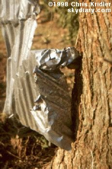 SALINA, Kansas — We’ve had a couple of days of BAD weather. Sunny skies, high heat. There’s a chance of storms today, but based on the data, I’m not getting my hopes up. Still, a couple of days ago, I got to see what the effects of an F3 or F4 tornado are really like.
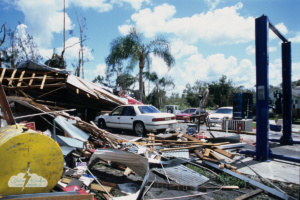
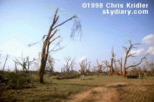 Our group went to Lamont, Oklahoma, where a half-mile-wide tornado — spawned from the same storm that produced the tornadoes we saw — seriously damaged several houses and blasted trees so that they looked as if they’d been through a firestorm. I saw the kind of legendary tornado “tricks” that people talk about — including pieces of hay and corrugated metal shot into trees.
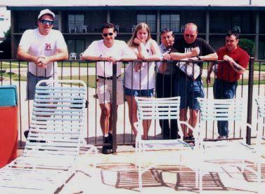
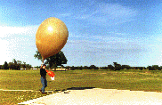 We return to Norman, a southern suburb of OKC, to see the evening launch of a weather balloon at the National Severe Storms Laboratory. Such daily launches provide the lab and its Storm Prediction Center with some of the data needed to predict severe storms.
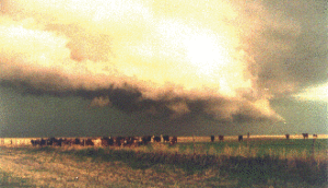 We stop twice in front of what has become a rapidly advancing gust front, a gloomy, undulating line of storm that isn’t likely to produce a tornado but is very likely to spit out hail and rain and fierce winds. It’s on top of us in a just a few minutes each time, sending the cows before it stampeding.
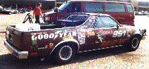 It’s Chaser Convergence, a common phenomenon when serious storm-chasers are after the same storm systems. VORTEX goes through. Matt Biddle’s decal-clad El Camino pulls in, though it appears someone else is driving. Marty Feely appears with one of his Whirlwind Tours. Jim Leonard and Casey Crosbie show up.
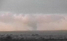 It breaks apart as we stop to watch the advancing storm.
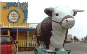 Steve and Charles discuss whether to chase. It’s a “slight risk” day. We decide to give it a shot, but first, a visit to an Amarillo landmark: The Big Texan. A colorful tourist trap, the restaurant-hotel-gift shop complex is designed to look like an Old West town. A elephant-size fake cow guards the front door. A sign tells us that if we can eat a 72-ounce steak in an hour, it’s free!
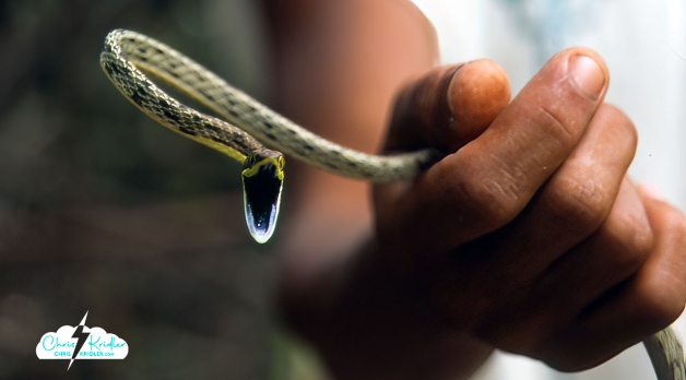
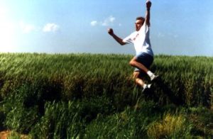 Along a road that looks like Prairie Stop in “North by Northwest,” The Bild reporter tries to melt his ice cream. The Bild photographer snaps pictures. Casey makes phone calls and jumps into a wheat field. Charles plays with his web site and computer games. Steve stares at the sky. Another German journalist, who has joined us for just a couple of days, sits in a dusty gully. I throw a little balsa-wood plane and run to retrieve it, only to screech to a halt in front of an enormous snake. We all gather around. It’s a rattler, all right, but it’s lost its rattle. After some rather foolish teasing by Steve, it slithers off into a wheat field.
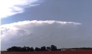 We end up between the storms instead, and they are the most dazzling of the trip. Serendipity guides us. The fabulous sunset sets afire both monster clouds, as rain hangs like feathery mist from their dark bellies. Mammatus clouds glow orange, and lightning forks to the ground and crawls across the sky. A breeze carrying fresh, brisk air whisks through our group. Charles and Lan set up cameras and shout ecstatically when the lightning bolts cooperate with their shutters. I take pictures until I run out of film.
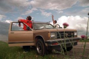 So the next day, Casey takes me and another hanger-on, Allan Rosenberg, storm-chasing. Allan, a lawyer, is the creator of a storm-chasing comic that is only available on the Web.
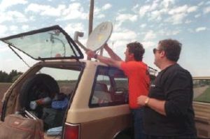 This is how the tour ends, not with a bang, but a whimper. Up into Nebraska we drive, then back down through Kansas, catching some minor storms on the way back to Norman. Charles is frustrated. I’m frustrated. Allan might be frustrated, but he’s not saying.