I have extensive archives from my early storm chasing years. I chronicled almost every day on the road, even bust days, at the old SkyDiary site, with lots of photos. In the interest of collecting everything in one place, I’m moving the highlights of the older chases over to ChrisKridler.com. 2006 was one of the worst chasing years in pursuit of storms, thanks to a crashing cold front, but it had a few moments.
8 May 2006
Chase time: Just a quick update. After a 21-hour drive, I’m in Broken Arrow, Okla., and not quite in position to chase today. I’ll need to do my forecast and drive some more to get there, wherever there is, but at least I feel like I’m back in Tornado Alley again. I love what one sees on the road: two billboards next to one another, one warning of fire danger, the other covered with flames advertising a barbecue joint. A sign that says “Watch for long logs” (insert your own joke here). Another for Toad Suck Park in Arkansas. Watermelons galore sold out of the backs of pickup trucks in Mississippi.
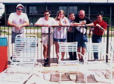
Update: I tried but didn’t see much today. Storms didn’t fire where people thought they should, though a big line of them formed in western Kansas, and I got a look. There were some pretty moments and a few good lightning bolts. It’s something and was a good shakedown cruise for gear, including the new ham radio. I’ve now met up with Scott McPartland, Dave Lewison, Pete Ventre and Jim Edds. Given a promised early start in the morning, I anticipate more sleep deprivation in my future. Now we’re at a terrible Days Inn in Great Bend that promised wi-fi, and it’s not working. My ceiling is leaking in the rain. And goodness knows if there really will be a promised hot waffle in the a.m. More later…
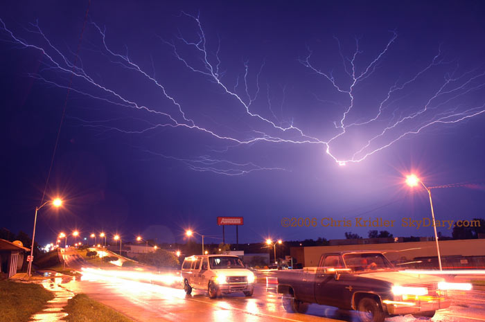
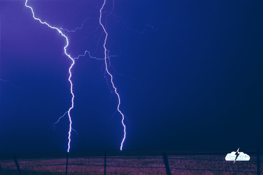
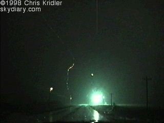
Lightning in McAlester, Oklahoma, May 9, 2006.
9 May 2006
The soggy and the sublime: After an unfulfilling chase yesterday, the hotel nightmare (even the advertised “hot waffle” was not the fresh-made thing you get at some hotels; it was a Kellogg’s toaster product), and continuing sleep deprivation, a chase finally was in the offing today. It provided some adrenaline and some pretty pictures, and that’s about all I can ask for.
Our party left Great Bend, Kansas, fairly early and headed south, checking data now and again to help us pick our target. The obvious choice was southeastern Oklahoma and the less obvious choice was north-west-central Texas. Finally, we settled on eastern OK. As half our party broke off north of Ada to say hi to Cloud 9 Tours, Jim Edds and I proceeded south and then east after getting a look at the towers going up in earnest on the boundary. It was imperative to get east, ahead of the line, or else it would be a day of core-punching. Not that we avoided cores entirely.
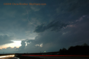
Mammatus and lightning in Oklahoma May 9.
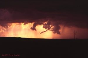
In McAlester, we waffled (again with the waffles!) about which storm to pick. A tornado warning was given for the storm to the south, but ours still looked good. We were about to give up on it when it became tornado warned, too. Then, on the west side of town, we spotted what appeared to be a rotating wall cloud. For a moment, I was wondering if we were about to have a tornado form over our heads. Then winds picked up like crazy and we thought we’d try to get east of it. Bad idea, or at least a bad road choice, not that there are any good roads out here in the tree-heavy hills. We got caught in serious horizontal winds — I’d guess about 70mph — with flying debris, driving rain, very low visibility and hail. The core, in other words.
After more storm maneuvering and finding we’d be in the path of another tornado-warned storm, we slipped west back into town and got some very cool lightning shots, Jim with his HD video, me with some video and a lot of stills. This good photo opportunity did a lot to make the day memorable. Now our party is back together, along with Dave Patrick and Kristy Randall, and Mark Robinson and his friend Brian. I’ve spent a lot of time in McAlester today. The problem for tomorrow is that the risk area is in more bad chase territory and way farther east than I prefer to go. Meanwhile, after that, the Plains may be shut down in terms of severe weather. Should I stay or should I go?
11 May 2006
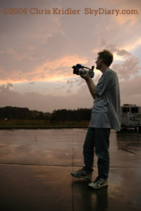
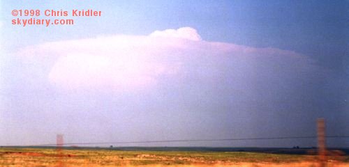
Mark Robinson films a storm May 10 as the season screeches to a halt.
The end already? I’m way behind on updates because of the lack of high-speed Internet and all the driving, which equals no time. We’re in Mississippi, for goodness’ sake. That’s not where we’re supposed to be to chase “Tornado Alley” storms.
We had a good target yesterday but were behind the game all day due to the long distances involved. We got wet and saw some lightning, that’s about it.
I’m actually giving it up for now and hope to come back to the Alley at some later date.
Florida skies
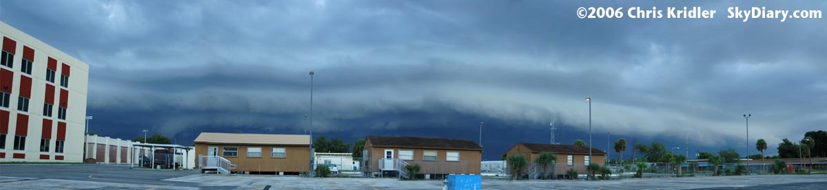
Shelf cloud in Rockledge, Florida, Sept. 2, 2006.
2 September 2006
A dramatic shelf cloud formed from a line of storms in Brevard County, Florida, on September 2. First, the pileus cap on top of the storm tower glowed in rainbow colors as the sun caught it from behind. Then the shelf appeared. Here’s a stitched-together panorama of several images of the shelf cloud as seen from Rockledge, Florida.
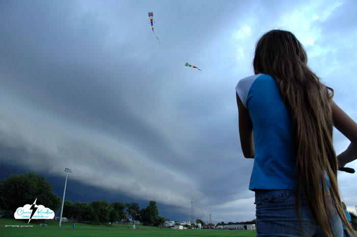
Kids fly kites before the storm, Sept. 2, 2006.
A couple of neighborhood kids were flying kites at the high school ahead of the storm. This is not recommended behavior in a lightning storm, but it was kind of beautiful.
 Last Thursday, Dave and I targeted northeast Iowa. Low pressure was moving into the area, which would cause the surface winds to come from the south or southeast, while upper-level winds were streaming in from the west. The result: shear in the atmosphere, meaning if a storm went up — and it was likely where the warm and cold fronts met — it would probably rotate.
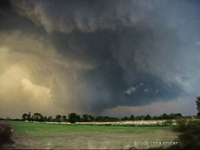
 Going backwards in time to May 16 — the day before — we played what seemed iffy chances for supercells in western Nebraska. We thought the action would be in extreme western Nebraska or even eastern Wyoming, especially after checking data and running into chasers Keith Brown and David Fogel (again in Ogallala). As we zoomed west, it became clear that this was going to be a major chaser convergence. Translated: A circus of idiot drivers. Now, obviously, I don’t think all chasers are irresponsible, but there are definitely chasers who are giving the rest of us a bad name. They are also becoming incredibly ostentatious, with loads of silly equipment on their roofs, including (in my opinion) useless marine radar units. What, are they going boating in their Ford Expeditions?
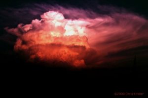 We saw the storm from when it was a pup, a little towering cumulus. It exploded and soon became a big bad dog — isolated. Huge. Multiple overshooting tops. But it was SCREAMING southeast, way ahead of us. It zoomed into Arkansas (Richard left us in mid-chase because of the hopelessness of the pursuit), and we had to listen to hail reports and spotter-reported tornado warning(s) as we tried to pursue it. We ended up in Arkansas, just east of Fort Smith, with a photogenic bomb that formed on its backside — very pretty, though it croaked at sunset. We met David O. Stillings, the Lightning Stalker (that’s just how he introduces himself, too, at rat-a-tat speed) and Jason Persoff, both Florida chasers traveling with a Pioneer Productions TV crew, as well as a couple of Arkansas chasers — Jason Politte and Scott Blair. We’re all part of a strange, little mobile community that keeps meeting on the grassy banks of farm roads in the middle of nowhere.
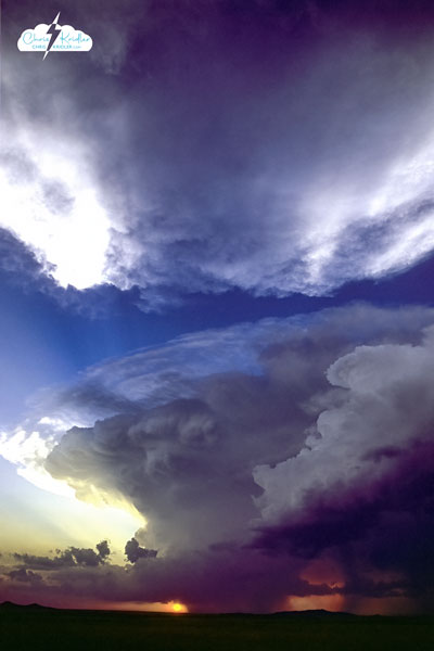
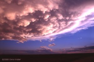

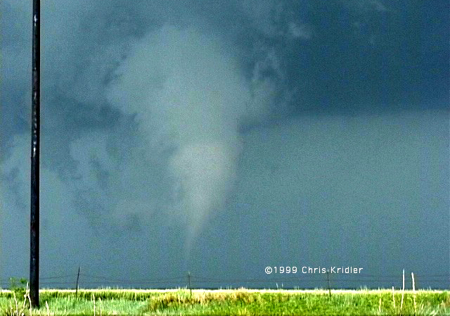
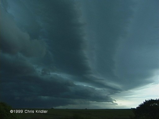

 I nearly gave up hope when I saw the tattered remains of a big storm, but I soon realized that several more were building. I headed further west toward one of them, and soon the radio station I was listening to was citing a Doppler-indicated tornado warning. But by the time I got near the storm, the warning had expired. Still, the lightning was amazing, and it was clear that major action was occurring, as I noticed another big “anvil” (blown off the top of a storm) to my south.
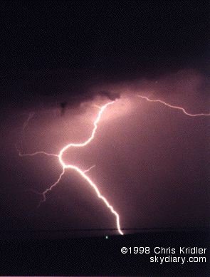
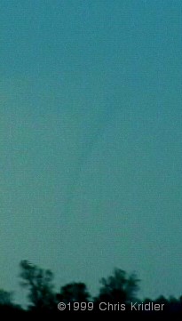
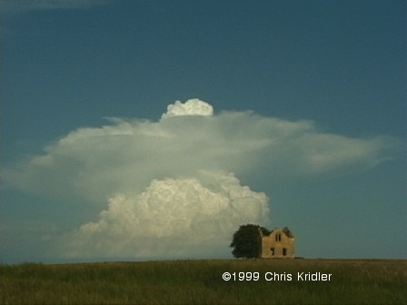
 The storm was a loner. That’s an encouraging thing, because no other storms were around to steal its energy (or steal its thunder). It was feeding greedily off the heat and moisture that had been building in the atmosphere and was soon a big fist sticking up. Then it mushroomed, growing in mass and spitting out a big circular anvil at its crest. An overshooting top showed a strong updraft. This was a monster in the making.
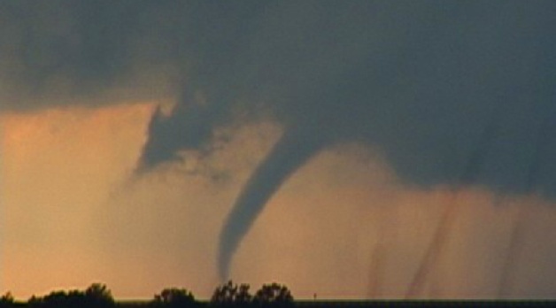
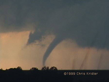
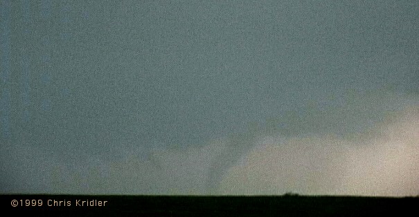
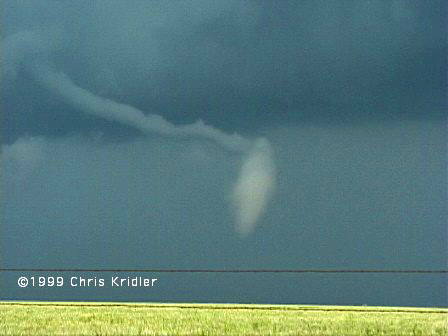
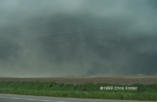
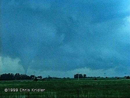
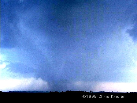
 Though it wasn’t particularly strong, it was dramatic — it spun up a big bowl of dust just north of the road and soon was writhing with dark reddish-brown tendrils. It looked as if it was going to cross the road just east of us. Everything was happening very quickly. And then the wind knocked over a telephone pole about 25 yards in front of us and the tornado turned south-southwest — headed right for us. We were in the “bear’s cage.” The other tour van, which was east of the tornado, zoomed east away from the twister as it got within a hundred yards of us, making our big van shudder with strong winds. We got turned around, briefly spun our wheels in the slope off the road and sped west away from it. It was thrilling. It soon crossed the road, weakened and died. Another small tornado spun up south of the road, which was filled with a sudden convergence of storm chasers and cops.

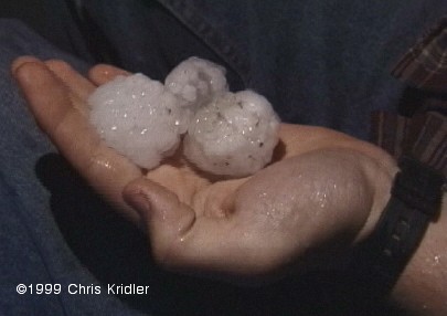
 SALINA, Kansas — We’ve had a couple of days of BAD weather. Sunny skies, high heat. There’s a chance of storms today, but based on the data, I’m not getting my hopes up. Still, a couple of days ago, I got to see what the effects of an F3 or F4 tornado are really like.
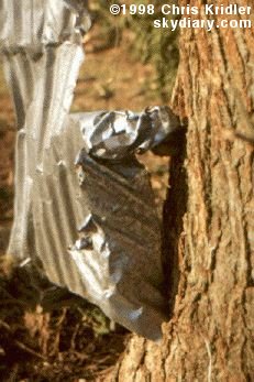
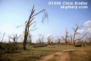 Our group went to Lamont, Oklahoma, where a half-mile-wide tornado — spawned from the same storm that produced the tornadoes we saw — seriously damaged several houses and blasted trees so that they looked as if they’d been through a firestorm. I saw the kind of legendary tornado “tricks” that people talk about — including pieces of hay and corrugated metal shot into trees.
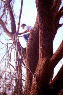