
May 17 offered a wild storm chase as Alethea and I met up with Jason Persoff and targeted southeast Nebraska. We sort of hoped that the Storm Prediction Center’s bull’s-eye centered in the northeast part of the state would pull more chasers that way, but instead, we ended up mired in the worst storm chaser traffic jam I’ve ever seen — and it cost us.
We waited in St. Paul for a while, watching the clouds develop, then went after a couple of storms popping up east of Ravenna and west of St. Libory. We monitored the developing storms as one became dominant, then repositioned south to get out of the rain and hail. This got us very close to the business end of the storm. We were in position to see the magic of tornadogenesis – but, as it turns out, out of position for what came next.
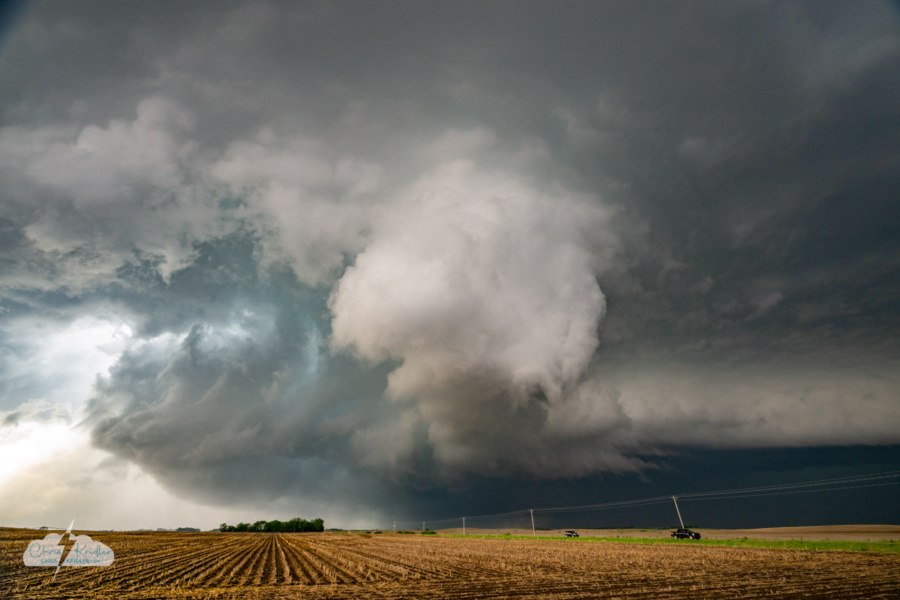
Tornadogenesis. The tornado begins right in front of us (see dirt in the distance). Note: Power lines removed in editing.
The storm was clearly rotating, and the structure looked chaotic. Its wall cloud was one of the weirder-looking ones I’ve seen, but it was whirling right in front of us. And then a tornado spun up under the spinning column of cloud. From our perspective, it was a rapidly rotating dust whirl moving east. Annoying power lines were in our way, but what a thrill to be so close.
And then, worse for us, a curtain of rain wrapped hard around the tornado with the rear-flank downdraft, smacking us with a wall of wind and water as we jumped into our cars and tried to get east.
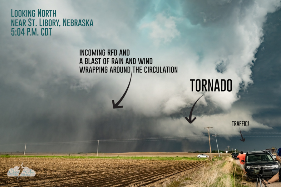
The annotated version showing the storm at 5:04 p.m. CDT.
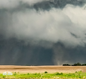
A cropped image of the St. Libory tornado in progress. I've removed distracting power lines from the image.
Chasers who had positioned east and especially northeast of the meso watched the increasingly large, dark tornado (and got into some big hail). But we crept along in a futile slog through the precipitation that blocked our view, stuck in stop-and-go storm chaser traffic. Chase foiled.
Seeing tornadogenesis was fascinating and thrilling, but not getting the payoff of seeing the mature tornado was painful.
Feeling defeated, we paused after a fruitless pursuit on dirt roads, poised to give up. Still, I was intrigued by the radar and wanted to head south and target a storm in the developing line. And along the way, as we headed east on I-80, we were treated to a developing field of mammatus clouds overhead. We had to stop and check them out.

The mammatus clouds framed by the trees. Amazing!
These pouchy, smooth clouds are often seen in association with severe storms, under the anvil, and these were particularly stunning, filling the sky. We paused at a rest stop near York, Nebraska, to photograph and film them.
I used a GoPro Max2 360 camera to capture the mammatus on video. Check it out; this is the extended version, more than you’ll see in the video above. It makes me feel like I’m floating through these magical clouds!
I shot lots of photos of the storm and the mammatus, which redeemed our chase day. Click on any image to see a larger photo and start a slide show.


 was of particular interest.")


. Note: Power lines removed in editing.")


")

 before rain obscured it. This is excerpted from a video frame as the rain began to hammer us.")


")


