
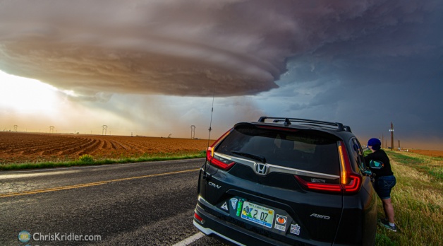
What an extraordinary day of seeing nature’s magic in action! Alethea Kontis and I started our storm chase on May 17, 2021, in Seminole, Texas, where we watched clouds bubbling on the dryline. Aggressively growing turkey towers (as seen in the video) suggested that storms were in the offing.
Jason Persoff found us by the side of the road. He was chasing with his son Kai, and we all headed north of town to watch the developing storms.
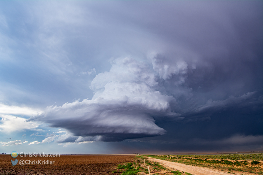
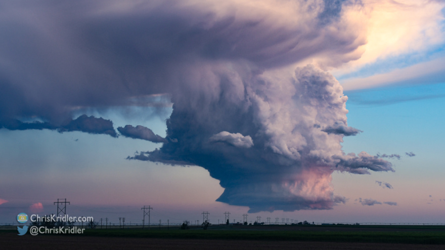
What a beautiful storm.
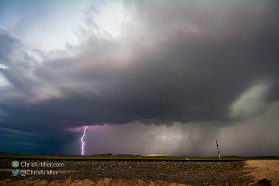
The first ones seemed to deflate quickly, but soon a small LP (low-precipitation) storm began to dominate the area around Brownfield. While a nice cone tornado occurred in the line of storms farther south, this one produced what was essentially a dust whirl under a nub of a funnel. Even though we were filming it, we didn’t see the whirling dust – probably because there was so much other dust in the way.
There’s a lot of timelapse in my video, and this spinning storm sometimes resembled a UFO descending upon the Earth.
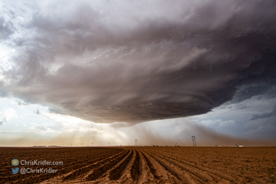
The brown fields of Brownfield reflected their color on the base of the storm.
Brownfield literally has a lot of brown fields, and interestingly, their color was reflected in the bases of the storms. So while I always enhance photographs to a point — I’m leaning more toward artistic photos these days rather than the flat, documentary style — those brown and rust colors are pretty much true to life.
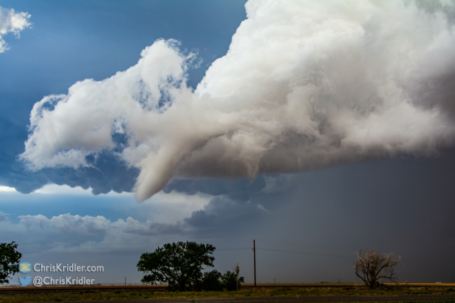
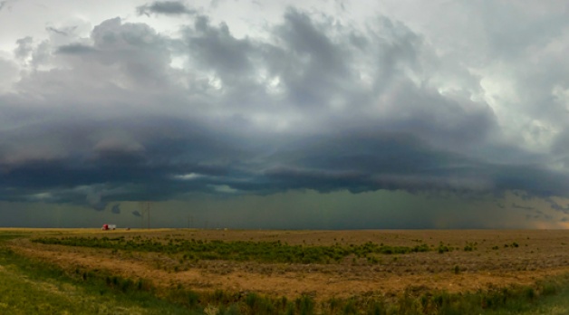
As we got into Lubbock, with the tornado sirens blaring, this funnel almost made it to the ground.
The storm moved into the south side of Lubbock and produced a long, white funnel that was just shy of stirring up circulation on the ground — i.e., no tornado.
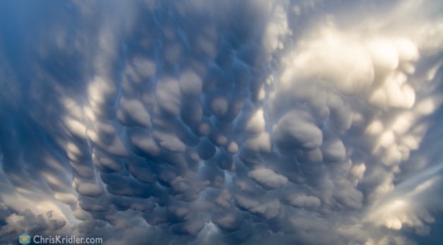
We watched the storm as it became disorganized but still produced a glorious display of convection, lightning and mammatus clouds at sunset. All in all, it was an exhilarating chase day with lots of photo opportunities.
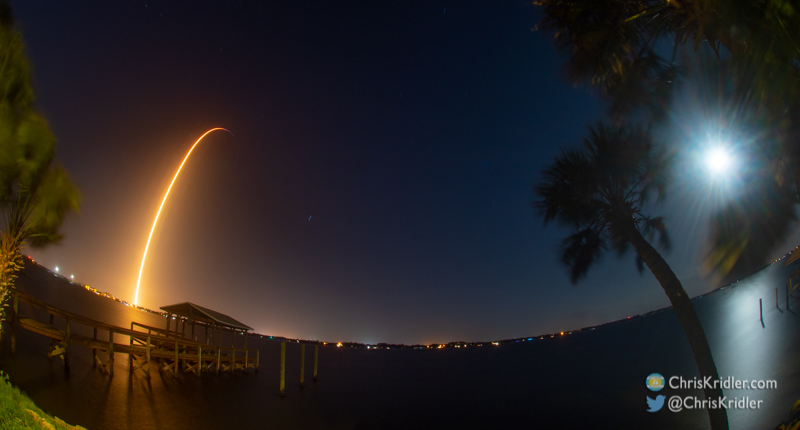
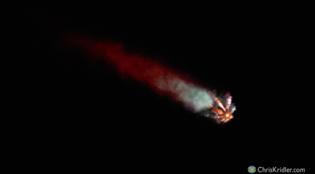
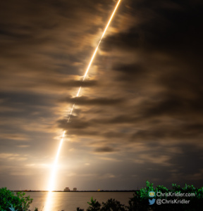
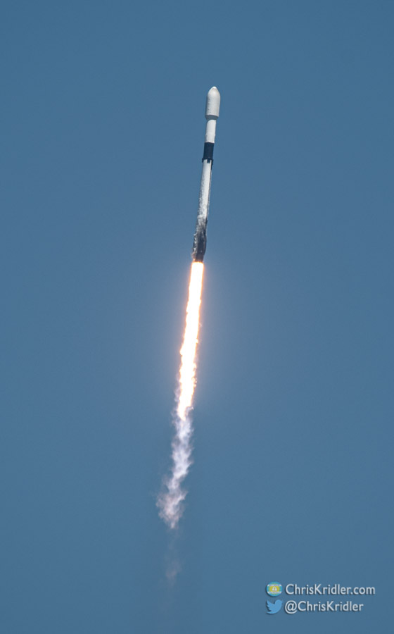
Roll over a photo to see a caption or click on one to start a slide show of larger images.


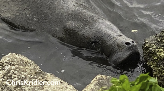
 I was lucky tonight to see a couple of manatees grazing along the edge of the Indian River Lagoon in Rockledge, Florida, and stopped to shoot a little video. They really lived up to their nickname, “the gentle sea cow.” I don’t think I’ve ever seen them elbowing their way onto the rocks at the water’s edge to get their dinner, as you’ll see in this short video.
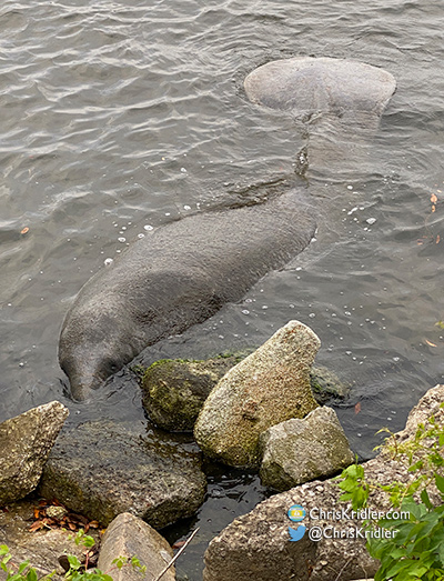

