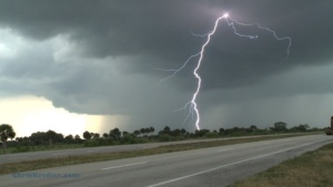
I’m getting ready to go storm chasing in May … and will be going a bit mad over the next few days during an expected outbreak of severe weather in Tornado Alley. (Do you have your weather radio yet?) So as therapy – and as part of a flurry of updates of my storm-chasing-focused sister site SkyDiary.com – I’ve put together a little video from an interesting chase on May 18, 2010, in the Texas Panhandle. Near Dumas, I saw one tornado. I also saw a huge, rotating wall cloud that was dragging its butt on the ground, but from my perspective, I couldn’t confirm a tornado. This storm was a perfect example of one that can inspire all kinds of specious tornado reports, thanks to all the dangling scud clouds, yet definitely warranted tornado warnings.

This storm rolled over Boynton Beach, Florida, during a storm chaser party on March 31, 2012. Photo by Chris Kridler, chriskridler.com
Saturday was a good warmup. That’s when Jim Leonard played host to a storm chaser gathering in Boynton Beach, Florida. There was good food, lots of good storm video, and lots of tale-telling, of course. Enhancing the experience were some pretty little storms that rolled through.

Jim Leonard at the grill.
There are a lot of storm chasers tearing their hair out tonight on Facebook as they see media coverage of the San Antonio tornado – and all the other tornadoes that have struck in the past couple of days. This is even worse than the “There was no warning!” cliche that showed up on ABC after a recent outbreak, when there was lots of warning, relatively speaking. In this case, as noted by chaser Scott McPartland, a TV station in San Antonio was telling people to send in their tornado photos in the middle of the event, when its audience was in imminent danger, instead of telling people in the path of the storm to seek shelter.
This kind of coverage is wrong on a number of levels, but just for starters, it’s encouraging untrained people to risk their lives for a photo. The request for images, especially during the event, subtly minimizes the danger by implying that it’s perfectly OK to stand outside in a tornado and take photos. Storm chasers do this kind of thing all the time, but we have some idea of how the storm will behave, in what direction it’s moving, and when to get out of the way. When “news” people take the same path as sensationalistic reality shows, which tend to present chasing as an amusement-park ride, they are sending a message that somehow holding a camera will prevent you from getting killed.There’s another side effect of this crowdsourcing of severe weather events: Photos of tornadoes from OTHER days and storms are being sent in and put on TV as part of the current event. This hoaxing is becoming widespread, and TV stations and other media outlets (print/online included), eager for free and dramatic content, are posting them without checking the facts. Not only are they treading on someone else’s copyright, like that of my friends at Cloud 9 Tours, but they are obfuscating the truth and making themselves look silly in the process.
I’m not into media-bashing. I still work for various media outlets as a freelancer. But news people have a job here, and it isn’t getting hot ratings. While many on-air meteorologists and journalists do a fantastic job of warning the public during severe weather, irresponsible coverage will only incur more criticism and damage journalists’ credibility. The first concern in a life-threatening situation should be to pass on warnings to the public, not get the “extreme” shot. And a little verification of all those nice, free reports from citizen journalists wouldn’t hurt. At some point, immediacy ceases to be an excuse.
Storm chasers get great footage, but some of the most dramatic and intense footage I’ve seen has been by people who shot tornadoes from their homes or backyards. It’s not just their proximity to the storm in question; the storms are coming to them, after all. It’s also the sense that their homes are in peril; that their nightmares are coming to life; that they’re envisioning the destruction and what will come after – or remembering a disaster that came before.
The character of Judy in my novel “Funnel Vision” has this feeling whenever she sees a tornado, and especially if a storm threatens her town in Kansas. It’s easy to put yourself in her shoes when you see videos like this one by Kevin Adkins from West Liberty, Kentucky, on March 2. I have dreams about wall clouds and tornadoes like this – massive and ominous, whose real-time rotation is so rapid it looks like a special effect. The fact that the tornado is grinding through the mountains makes this video even more surreal; like a horror-movie monster, its terrible form can’t be seen until it’s just about to consume you.
I was on the East Coast Monday while beastly tornadoes hit Oklahoma. You may have seen the video of chaser Andy Gabrielson’s car rolling over while chasing one of them. He says the steering locked up, but whatever happened, it happened while he was driving backward at high speed. I’d prefer not to be so close that I have to drive backward to get away from anything! Andy, fortunately, was not badly hurt. Here’s the TornadoVideos.net (Reed Timmer’s crew) video of the incredible tornado, and Andy’s car flipping (at about 1:40).
What did I see yesterday? A pleasant little rainbow over the Atlantic Ocean.
I used the Nikon D7000 to shoot Hurricane Irene’s big waves in Cocoa Beach on Friday as the storm missed Florida but, nonetheless, churned up the Atlantic.
It was challenging getting the focus right with all the glare. Guess I have to bring a blankie to cover my head next time. Still, the waves were pretty awesome! This is a one-minute look.
Usually, in Florida, this is about the time we hold our breath and check to make sure our belongings are as secured as they can be and doublecheck the boards (or shutters, or whatever) on the windows. But it appears Hurricane Irene’s worst will be reserved not just for the Carolinas, but for the northeast. I’ve always wondered how the northeast would react to a storm like this. Unfortunately, we’re about to find out. I’d encourage residents up and down the East Coast of the United States not to take this storm lightly. Secure small objects, lay in a supply of water (one gallon per person, per day) and batteries for flashlights, and have enough nonperishable food to last three days. Even being without power for a few days (let alone weeks) can be miserable, and if you don’t have the right supplies, it’s much worse. You might also stock a cooler with ice. It won’t last forever, but it can tide you over. We also make sure we have gas for our generator and propane for our grill. The grill, which also has a burner, meant we ate pretty well in 2004 when we were without power after both Frances and Jeanne. Plus it’s a way to cook meat that’s in your freezer before it goes bad. Also make sure you have a car charger for your cell phone, make sure your car has gas, and get some cash ahead of time.
Here are my links to tropical weather data, including model tracks.
Here are FEMA’s hurricane preparedness tips.
Want to learn more about hurricanes? See the Sky Diary kids’ hurricane page.
For entertaining, thorough weather discussions of Irene and Florida weather in general, check out Steve Sponsler’s High Speed Dirt blog.

Lightning flashes over the Atlantic Ocean, as seen looking east toward Cocoa Beach and Cape Canaveral, Florida, from across the Banana River. Photo by Chris Kridler, chriskridler.com

A lightning crawler and CGs on August 17, 2011, as seen looking east toward Cocoa Beach and Cape Canaveral, Florida. Photo by Chris Kridler, chriskridler.com
I love to see an isolated cell light up right at sunset, and over water, it’s even better. This was more of a cluster of cells, and they produced a few nice bolts before they croaked. I’m sure I missed a few as I drove over Merritt Island and got into position on the Banana River to take photos (and donate a quart of blood to the mosquitoes).
The lightning may have been sparse, but it was pretty. I’ve found sometimes the best crawlers happen in the dying phases of the storm, and sometimes you have to wait several minutes between flashes to nab them. But this storm hovering off Cape Canaveral really stopped when it stopped producing, allowing me to get several more mosquito bites as I painstakingly held the shutter open for 20 or 30 seconds at a time, hoping against hope. Oh, well. Comes with the territory.

A close lIghtning bolt overexposes the frame on August 1, 2011, over Viera, Florida. Photo by Chris Kridler, chriskridler.com

A passing car obscures a photograph of lightning, casting a "shadow" at the bottom of the frame, on August 1, 2011, in Viera, Florida. Photo by Chris Kridler, chriskridler.com
Earlier Monday, I drove south to check out some storms and saw a lightning bolt hit well ahead of the rain and clouds – one of those bolts from the blue. That’s why the lightning safety folks say, “When thunder roars, go indoors.”