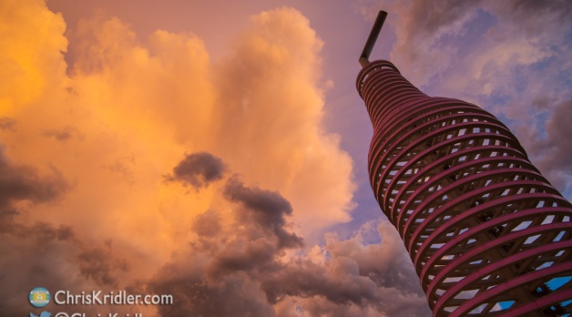
Chris Kridler
Chris Kridler is a writer, photographer and storm chaser and author of the Storm Seekers Series of storm-chasing adventures.

Chris Kridler is a writer, photographer and storm chaser and author of the Storm Seekers Series of storm-chasing adventures.
Hubby just made a Puhi Split. This sounds more gymnastic than it is. It’s a wonderful cocktail with macadamia nut liqueur, dark rum, Kahlua and cream. Oh, and fresh banana, blended with ice. Amazing. He found the recipe on Tiki Central. That Trader Vic’s Macadamia Nut Liqueur is serious girl-drink goodness, but the guys like it, too.

Easter cocktails: Blue Egg, Green Egg, Pink Egg (courtesy Deussen Global)
It’s been a busy week for cocktail press releases in the mail. I know, these recipes are just designed to push certain kinds of liquor, but don’t they look good? Of course, I am somewhat suspicious of “elixir”-colored drinks, as the recipes designate, and I don’t generally consider Easter a big drinking holiday, but some would argue that every holiday is, especially those spent with large, dysfunctional families. I found at least one of these recipes, the Blue Egg, elsewhere online under a different name. The Blue Egg features vodka; Green Egg, absinthe; and Pink Egg, rum. What do you think of strangely colored drinks? I love Beachbum Berry’s take on the Mai Tai: “A Mai Tai should not be red. A Mai Tai should not be blue.” But judge for yourself; here’s the Green Egg: Combine 2 ounces Lucid Absinthe; 0.5 ounce lime juice; 1 ounce Coco Lopez; and Teal Elixir #5 in a shaker with ice. Strain into a tall rocks glass with ice and top with Lucid Absinthe. Garnish with a lemon, lime, and maraschino cherry.

Bakon Vodka Bloody Mary
Also this week, I got a press release congratulating me, because at last, in Florida, Bakon Vodka is available. It tastes like – yeah, you guessed it. They recommend it for Bloody Marys.
Another press release offered the Bringing Home the Bacon: Rim a shot glass with maple syrup and cover rim with bacon bits. Fill the shot glass with Hornitos Anejo (or the tequila you prefer). Simple enough. Bacon. Not just for breakfast anymore. Or maybe tequila is for breakfast? You decide.

Champagne cocktails. Oh, the joy of tiny bubbles.
I’m in the process of doing our taxes, which means reviewing a year’s worth of expenses, and they can be kind of disturbing when grouped into categories. Especially “Restaurants.” One of our credit cards had enough restaurant expenses that they could be traded for a small used car. Granted, many of these were accrued as I reviewed restaurants for Florida Today, but given I had a limit even on those expenses, it still means we dine out a lot. I think as I become self-employed we will still enjoy dining out, but I hope we’ll also have time for more gourmet prep at home. And I still love shooting pictures of food and drink. This photo was from a holiday/champagne cocktail shoot in FT’s television studio.

The dogs are ready to sleep. I am, too.
I still have a lot more I want to do with the site, but a girl has to sleep sometime. Stay tuned, and you will see the design evolve, particularly on the gallery pages.
This is Chris Kridler, and I’m just starting to develop a portfolio and blog web site to complement my storm-chasing site at www.SkyDiary.com – check it out to chase the storms!
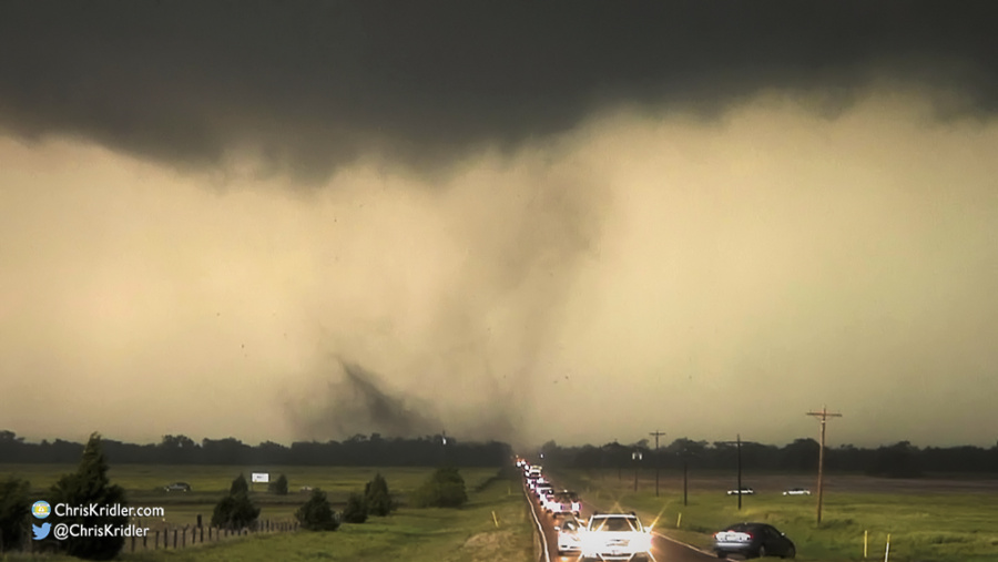
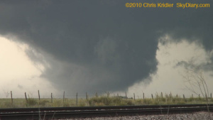
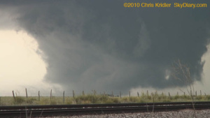
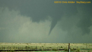
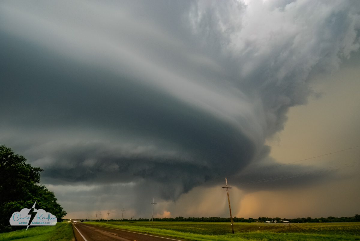
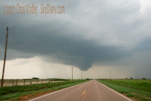
A multivortex tornado chases the chasers down the highway in northern Oklahoma on May 10, 2010. Photo by Chris Kridler, ChrisKridler.com
I have extensive archives from my early storm chasing years. I chronicled almost every day on the road, even bust days, at the old SkyDiary site, with lots of photos. In the interest of collecting everything in one place, I’m moving the highlights of the older chases – or quirky moments worth remembering – over to ChrisKridler.com. With that in mind, this post collects just a few of the posts from 2010 and a few photos to accompany them.
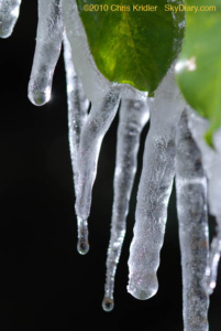
Jan. 6-10, 2010: Several nights of freezing temperatures shocked central Florida and its plants at the start of January. I caught a few photos of sleet and ice – a very strange thing to see in Brevard County.

On Jan. 6, 2010, our fountain froze, as it did many days during the cold snap.
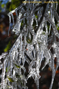
I have to thank the neighbors and their gratuitous use of a garden hose for this ice sculpture Jan. 10, 2010, in Rockledge, Florida.
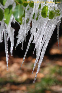
A shifting branch during the melt meant crooked icicles Jan. 10.
Another look at the neighbors’ ice fantasy – when hose meets tree meets freezing temperatures on Jan. 10, 2010.
Feb. 11-12, 2010: Right after one of New York’s Snowmageddons this winter, I got some snowy shots in and around Central Park.
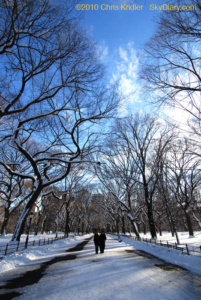
It’s better to walk with a friend…
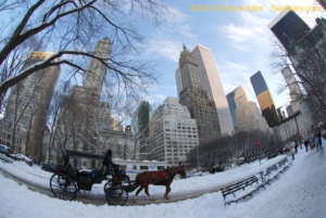
Hard-working horses.
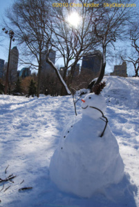
A snowman suns himself.
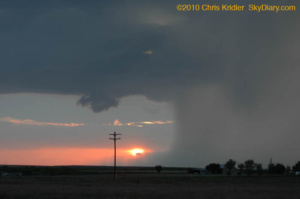
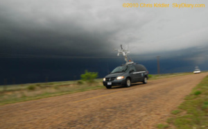
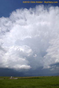
May 10, 2010: This was one of those absolutely nuts, off-the-hook storm days. The models had suggested it was coming for days, so every chaser and media person you can imagine was out to see the disaster in the making. Then the Storm Prediction Center issued a high risk of severe storms, including strong tornadoes. The big problem for chasing: They were expected to haul butt northeast at highway speeds, meaning you couldn’t really chase the storms very well – you had to put yourself in front of them and hope. I started the day in Norman, Oklahoma, and picked Ponca City as a preliminary target. I ended up meeting up with Scott McPartland, Dave Lewison, Mark Robinson and Mark’s crew of meteorology types in Blackwell, in north-central Oklahoma, and we went after a storm that went up near Woodward. (From home, Steve Sponsler and Cheryl Chang both said it split.) We caught it as it put down a brief but pretty tornado. Churning east, suddenly, instead of northeast, it then put down a multi-vortex tornado. I regret not getting more video or stopping for longer than a few seconds, but it literally chased about a hundred chase cars down Route 11 at about 55 mph. NOT a good situation. As it finally eased north of the road, the radar hook on it indicated a big (if unseen and rain-wrapped) tornado. After that, I did a lot of stair-stepping east of I-35, trying to catch another storm, but it was darn near impossible. I hope my next chase is a slow one. Many, many tornadoes occurred today, costing lives and causing damage. It was a tough day and a sad one.
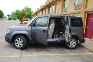
My new Element was ready to go on its first storm chase.
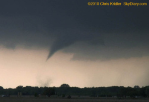
A tornado touches down briefly southwest of Wakita, Oklahoma (that’s the town destroyed in the movie “Twister”).
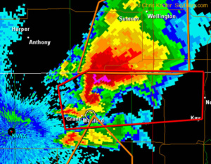
When I finally got far enough east, I grabbed a frame of the radar showing the storm’s classic hook, indicating a big tornado. If there, it was wrapped in rain. I’m the dot in the circle.
May 11, 2010: There are more people pictures than sky photos in this summary, because this was a classic storm chase in the sense that we ended up waiting around a lot for the cap to break. Today I took along a friend for her first chase, Tiffany Crumrine. We chased with Scott McPartland, Dave Lewison, Mark Robinson and crew, and met up with various folks along the way before becoming separated from them all (except for hearing them over the radio). What seemed like a significant storm potential and a lot of juice went to waste before sunset with little in the way of storms – except one pretty, tornado-warned corkscrew, below.
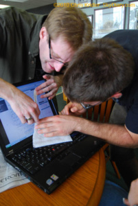
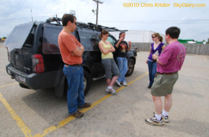
Mark and Brad use a knife and a napkin to properly read a hodograph during forecast discussions at the Guest Inn in Norman, Oklahoma.
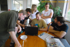
Further forecast discussion at the Guest Inn. Note the newspaper on the table with headlines about the previous day’s tornadoes.
Here’s a parting shot of the storm, which soon shrunk out of existence.
May 12, 2010: Any hopes for isolated storms today were dashed pretty quickly once the line went up. A few remained discrete for a little while, and we followed one from Alva, Oklahoma, into Kansas, but we missed the rare tornadoes today. I chased with Scott McPartland and Dave Lewison, and Mark Robinson and his crew.
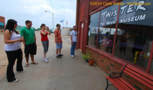
We made a stop at the Twister Museum in Wakita, Oklahoma, on the way to a chase target farther west.
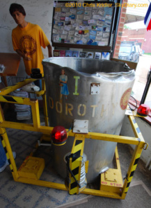
The Twister Museum holds “Dorothy I,” the prop from the movie “Twister.”
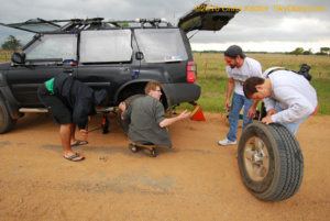
Brad, Mark, Scott and Dave snapped into action to change a tire before the line of storms could overtake us.
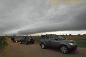
Our caravan lines up to watch the outflow boundary in motion.
May 16, 2010: I was on my own today. I drove from Carlsbad, New Mexico, to Odessa, Texas, and got an oil change, expecting that I might have a chance to chase whatever popped up later in that area. But by the time I was done, the biggest severe storms were going up in Oklahoma. That was out of reach, and I liked the boundary and bit of moisture convergence in eastern New Mexico, near Clovis. I started heading in that direction when just a few compact storms started to pop. Despite less than ideal conditions, a couple went severe, slowly moved southeast, and made for a fun and photogenic chase.
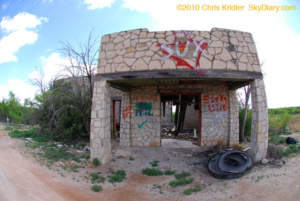
One can imagine this building’s better days.
The hail shaft had a deceptive, tornado-like appearance.
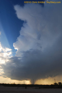
The heavy precipitation core, the sunset and a nascent wall cloud.
May 18, 2010: I started the day in Lubbock, Texas. It seemed to me the best conjunction of moisture, wind profiles and other factors pointed to the Oklahoma-Texas border in the northwest Texas panhandle. As I drove into Amarillo, I heard the old crew (Dave Lewison, Scott McPartland, Mark Robinson and friends) on the radio and met up with them and with Bill Hark in Dumas. We went to Dalhart to wait for a likely storm, and a blip on radar near Dumas quickly became an amazing, isolated supercell. Our crew split up, but I met them later. I say I saw “at least one” tornado today because one was obvious. Another sure looked like one, but I’m waiting for confirmation. And who knows how many I filmed in the dense hail/rain core without knowing it. There were a lot of “scud bombs” hanging from the storm that probably prompted reports, too.
Bill Hark, right, flew in from Virginia for the chase. We waited around Dalhart, Texas, until the first blip went up on radar.
At this point, the wall cloud may have been on the ground – that is, a tornado! My video shows strong rotation, and a series of video grabs shows what looks like dust on the ground. I can’t confirm it was, however, because I wasn’t close enough.
If it wasn’t a tornado, it should have been.
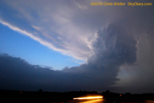
Then the storm formed an unquestionable tornado.
A Vortex 2 probe zooms down a ranch road near Stinnett, where a large tornado was reported in the precip core as the sirens blared.
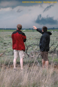
Mark and Brad scan the storm outside Stinnett at dusk as we let it slip by.
May 19, 2010: I started the day with Scott McPartland, Dave Lewison, Bill Hark, Mark Robinson and crew in Shamrock, Texas. We drove to Weatherford, Oklahoma, to wait for storms to fire. A couple did and almost immediately produced tornadoes, but we were nowhere near them – and then, as the storms went more high-precipitation and we caught up with the one near Leedey, it provided awesome structure but not much in the way of tornadoes unless you were in the hail or flying a news helicopter (one got great footage of a tornado near Kingfisher). It was still a fun chase. We split up as we caught up with the storm. I chose to stay south of it and got some nice pictures of the rotating mesocyclone, the hail core and a funnel west of Guthrie, where the tornado sirens were screaming as I drove through. I ended the day with a fantastic sunset in Arcadia, as the storms moved east and my Plains storm chase winds down.
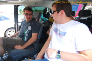
Brad and Dave discuss their options.
We caught up with this storm near Leedey shortly after it produced a tornado. The convection was impressive.
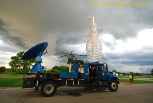
I stopped at Pops in Arcadia, an awesome gas station/restaurant/shrine to soda (with 500 types). Josh Wurman was getting interviewed in front of the giant bottle sculpture.
Our group met up again in Shawnee to share tales of hail, tornadoes, muddy roads, and chaser follies.
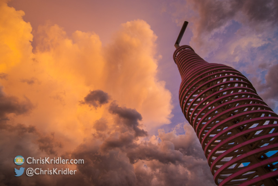
Pops on old Route 66 northeast of Oklahoma City on May 19.
September 2, 2010: It’s been an excruciatingly dull summer in terms of weather, but distant Hurricane Earl generated photogenic waves off east-central Florida as it neared the Carolina coast. These shots were taken in Satellite Beach.
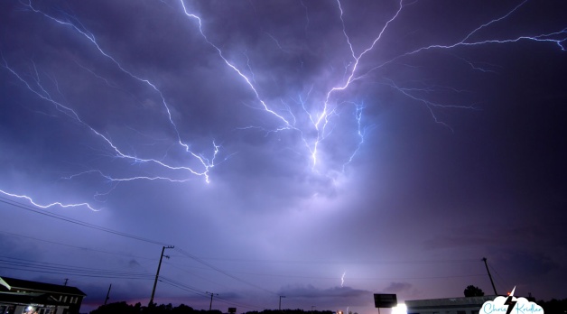
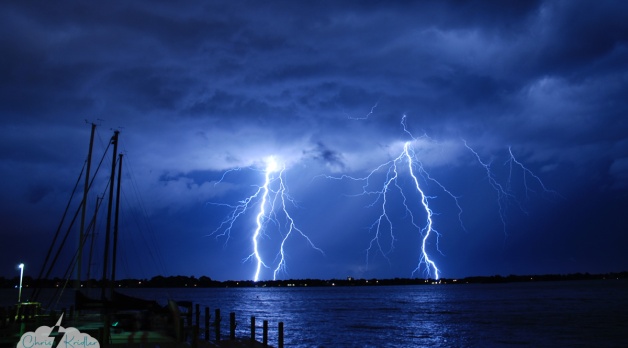
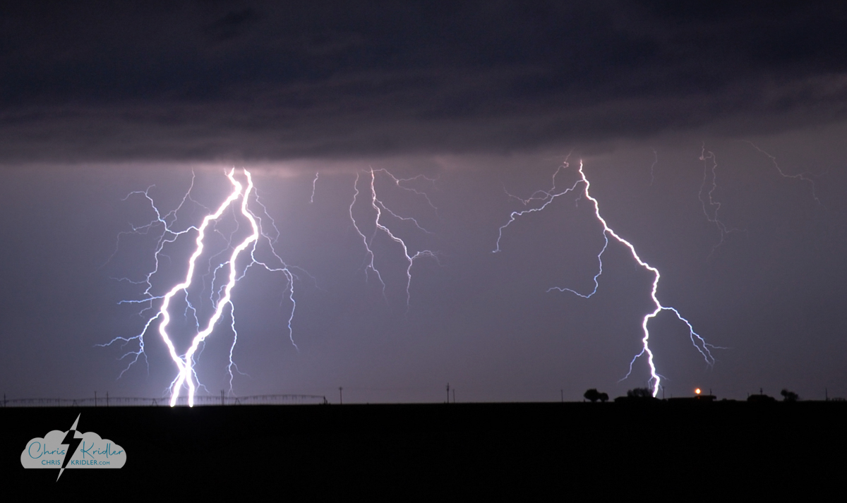
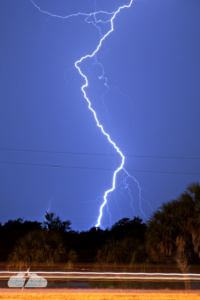
Lightning May 12, 2009, in Childress, Texas.
I have extensive archives from my early storm chasing years. I chronicled almost every day on the road, even bust days, at the old SkyDiary site, with lots of photos. In the interest of collecting everything in one place, I’m moving the highlights of the older chases – or quirky moments worth remembering – over to ChrisKridler.com. With that in mind, this post collects just a few of the accounts from 2009 and select photos to accompany them.
May 2, 2009: I began my trip to the Plains to chase storms, never dreaming I’d actually be chasing on Day One during my long drive from Florida. I saw a couple of tornado-warned storms in Mississippi, but no tornadoes. I drove over 900 miles on this day, and a ridiculous number of hours after leaving home at 5:30 a.m. EDT.
May 3, 2009: I woke up in Jackson, Mississippi, on May 3 to the first wave of squalls hammering the hotel. After a snooze, I got up about an hour later and saw a huge bow heading our way on the radar. I was out of the hotel by 9 a.m. and heading south on I-55. It looked like a cell was forming ahead of the line. I dropped south, then, trying to intercept the tornado-warned advance cell, made a problematic decision to take a tiny, windy road northwest into what was essentially a forest.
I started to make my way toward a main road and saw lots of branches and some trees down. This was in a rural area west of Hazelhurst. I was so close to the main road when … yep, a tree down, blocking my way. I thought that might happen. Here I am checking out the fallen tree. My superpowers failed to manifest, so I had to leave it, turn around and find another way out. I gave up the chase and headed west.
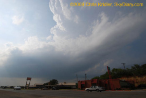
May 5, 2009: My initial target was somewhere between Abilene and Seymour, Texas, where the dryline push and warm front were likely to intersect and where upper-level winds would enhance storms. I would refine that forecast on the road. I left Amarillo in the mist and cold and, after a data stop in Childress, I dropped south.
I found the Cloud 9 Tours group in Aspermont, so I goofed around with them for a while as I kept an eye on the clearing satellite picture. I left the Cloud 9 folks because I wanted to get a little southeast, where the forecast suggested storms might fire, and near the field of cumulus clouds near the warm front. This is east of Anson. At first, they weren’t much to look at. Soon, the clouds starting percolating in the afternoon heat and began to form a nascent storm, here seen from a picnic area that overlooks Hubbard Creek Reservoir, west of Breckenridge. From Breckenridge, the tower looked solid. At this time, I began to see massive chaser caravans.
Here’s a view of the base, as seen from Breckenridge.
Though the storm became disorganized, the towers at its southwest end began building and dominating. This is just east of Breckenridge. I ran into the Cloud 9 group again. We were among dozens of chasers (at least) who were following the storm.
I repositioned and got a nice view of a wall cloud forming. It began rotating as small hail began falling around me. Driving through the hail was stressful, but I stayed ahead of the bigger stones, despite a lot of banging on the car. The reward: this beautiful rotating wall cloud crossing Interstate 20 at Route 16.
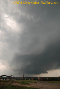
The rotation made it seem likely a tornado was imminent.
Driving through the hail was stressful, but I stayed ahead of the bigger stones, despite a lot of banging on the car. The reward: this beautiful rotating wall cloud crossing Interstate 20 at Route 16.
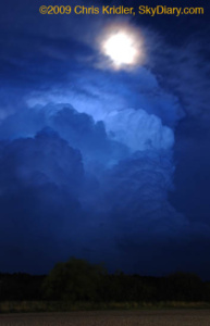
The National Weather Service cited a preliminary storm report of grapefruit-size hail – 5 inches across – with this storm, just north of our location, and it was moving southeast. I bailed and took shelter, but I missed the worst of the core. A baseball-size stone cracked John Guyton’s windshield. Meanwhile, I got a few shots of the retreating storm and the rising moon.
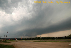
May 8, 2009: Most of today was frustrating. I began the day in Bartlesville, Oklahoma, and decided the front and the monster convective potential suggested southeast Oklahoma might be the place to catch storms today, or somewhere along the Red River between Oklahoma and Texas. I made the long drive down to Durant, Oklahoma, on the border, had a late lunch and pondered my options. I decided I needed to get a little west, closer to the front, and also wanted to keep an eye on a line of cumulus clouds developing in clearer air in Texas. Those started to pop, and I made the decision to go south. A while later, I decided I didn’t want to bother with those south-moving hailers, especially because it might take a while to catch them – yet a tornado was reported from one of them in Early, later. Meanwhile, a line of storms was going up to my west, so I checked them out. The result was beautiful.
Storm on fire!
May 12, 2009: What a crazy drive today. I started in Woodward, Oklahoma, and at first thought about an Oklahoma panhandle target. But as the day wore on, the models’ meager forecast of precipitation there evaporated, and it seemed like the southwest Texas panhandle would be more likely. Thanks to Steve Sponsler for data updates.
Though it looked ominous, the storm appeared linear and unlikely to produce a tornado.
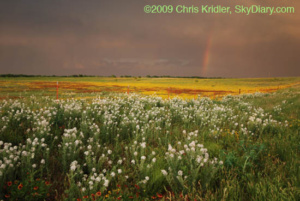
More flowers and another rainbow near Estelline, Texas.
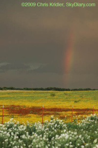
A rainbow closeup.
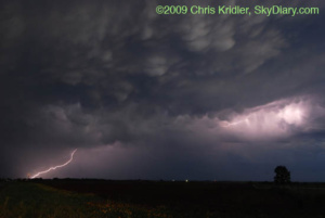
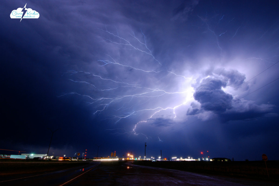
Mammatus and lightning northwest of Childress.
Lightning over Childress.
Instead of watching this pretty thing, I probably should have been driving east and getting ahead of the storm…
May 15, 2009: It seemed clear that there would be storms today, and that they would likely develop rapidly into a squall line once they fired. I thought about a couple of possible targets – the Texas panhandle, where storms could be more isolated on the dryline, and the Kansas-Oklahoma border near Alva, which was not an unreasonable drive (always a consideration) and also had enough upper-level support and huge convective potential to make me think something interesting might happen there. Eventually, there was a tornado reported in the panhandle, but I had cast my luck with northern Oklahoma.
Beams of light and pretty convection.
Sweeping in.
Looking to the north.
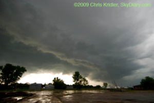
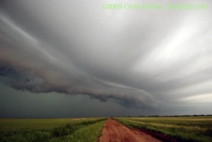
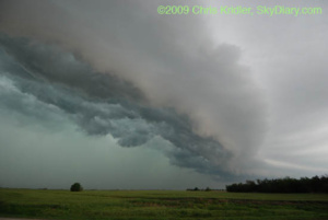
May 26, 2009: Florida is king of the shelf clouds. Here’s a beautiful layered gust front approaching the Brevard County coast from the west.
The shelf cloud looms.
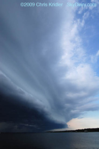
Beautiful layers appeared in the shelf cloud.
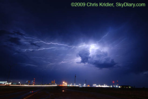
June 22, 2009: After days of unusually high temperatures of high 90s in the shade, the Storm Prediction Center put Brevard County, Florida, in a severe thunderstorm watch this evening. Storms broke late and brought with them nice lightning as they moved in fast from the north.
Lightning shot from Cocoa Beach, looking west, on June 22, 2009.
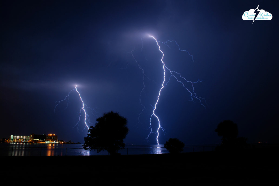
July 24, 2009: The evening began with a farewell to my husband’s brother – a memorial at Lone Cabbage Fish Camp in Cocoa, Florida. Then the skies opened. I had my camera, so when the gathering was over, I sought out the storm. This was one of the best nights I’ve seen for lightning in a long time here.
The storm cluster became more vigorous as it slowly edged closer, as seen over the St. John’s River.
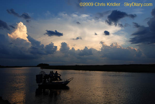
The sunset and storms provided a classic Florida scene as this airboat tried to get going at the Lone Cabbage Fish Camp.
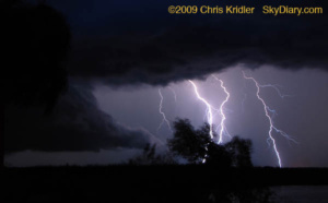
More bolts spring from the approaching storm.
I love the reflection of the lightning in the water. I think this is my favorite photo from this stage of the evening. This is full-frame, not cropped.
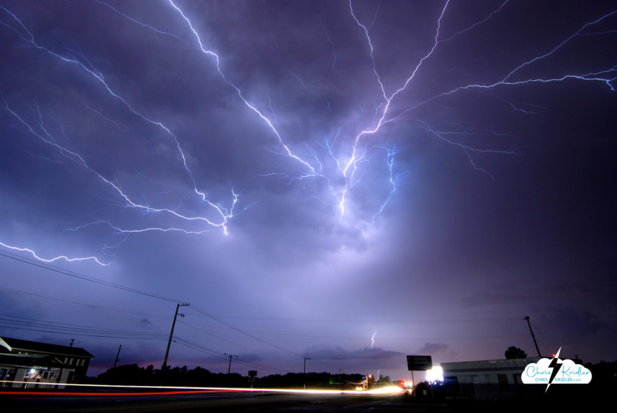
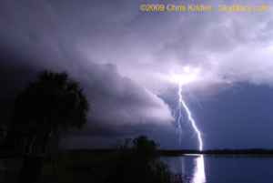
More great color and light – crawler above, traffic below.
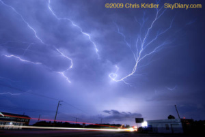
These just seemed to rip across the sky.
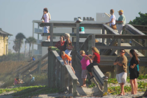
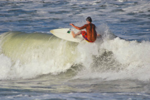
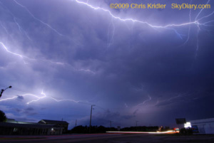
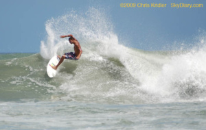
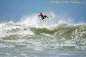
August 22, 2009: Hurricane Bill took pity on Florida and swept on by, but it delivered a boon to surfers in the form of big waves. Here are some shots on a beautiful beach day at the south end of Patrick Air Force Base (Satellite Beach).
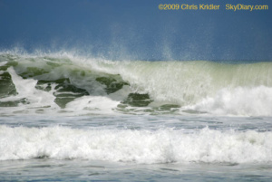
Whipped cream and emerald frenzy.
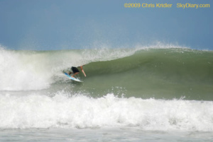
In the tube!
The arc.
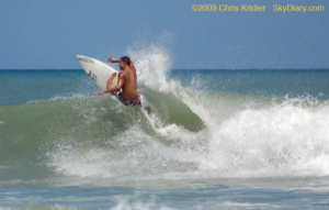
Taking off.
Airborne!
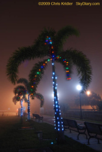 December 14, 2009: A fog event right out of a science-fiction movie rolled into Brevard County on Dec. 14. When I drove to the barrier island in the late afternoon, the fog seemed to be enveloping only the beach communities. Then it moved inland. I got just a few photos in Cocoa Village of the Christmas lights in the fog.
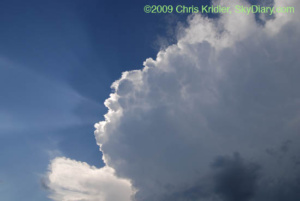
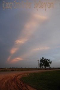
A funnel emerges from a lowering June 7. This storm produced a brief tornado in Kansas.
I have extensive archives from my early storm chasing years. I chronicled almost every day on the road, even bust days, at the old SkyDiary site, with lots of photos. In the interest of collecting everything in one place, I’m moving the highlights of the older chases over to ChrisKridler.com. With that in mind, this post collects some of the accounts from 2008 and select photos to accompany them.
Closeup of convection feeding into the May 1 storm.
The day after: The day after the first chase of the year, that is. I am trying to achieve that Zen balance between overwhelming anticipation and extreme pessimism. The results of yesterday, May 1, met me in the middle. I started the day in Muskogee, Oklahoma, and moved west and north to meet the dryline and what I thought was the best potential near the Oklahoma-Kansas border.
I saw a great rotating storm, but I did not see a tornado (a spinup was reported with my storm; perhaps I wasn’t close enough to see it). And actually, because it was so gorgeous, with its crisp anvil, aggressively bubbling flanking line and a short period of flying-saucer-like laminar beauty as it moved with the line of storms, I wasn’t disappointed when I saw the grainy twilight tornado video from Oklahoma on The Weather Channel this morning. I had a good chase.
Now, there will be a lull of at least a couple of days. I guess I’ll set out from my current stop of Independence, Kansas, and dig up a few more Tornado Alley tourist attractions to see. I enjoyed seeing Bartlesville’s oil well in Oklahoma yesterday. But one can gaze upon Cawker City’s big ball of twine just so many times before it becomes too dazzling to bear …
The yellow brick sidewalk in Sedan, Kansas.
Chasing choices: People who don’t chase storms sometimes wonder how I can’t see a tornado when there are dozens reported on a particular day. It looks easy when you see all those red triangles on The Weather Channel or Storm Prediction Center maps. But what the maps don’t tell you is (1) a lot occur at night; (2) if they are in certain parts of the country, like the South, they may hide amid trees and hills; (3) some are wrapped in rain, even if it is daylight; (4) not all reports are valid; and (5) even if they are visible, you have to be in the right place at the right time.
Sometimes a chaser decides it’s just not worthwhile. I wasn’t the only chaser to choose not to try to chase the squall line in Arkansas and environs today. Even though there have been several tornado reports, I would have been dealing with the aforementioned trees and hills. Not only that, but I would have had to drive many hours on little sleep, through a squall line going only slightly slower than myself, meaning I would have been driving in horrible rain etc. for a long time; and after all that driving and marginal chasing, I would have had to return back west to be in position for what I hope will be a better (and more visible) chase in a couple of days. And there are the gas prices.
So after Thursday’s chase and late night and not quite enough sleep, I decided to take it easy and amble from Kansas down to Norman, Oklahoma, on Friday. I always seem to come back to Norman at some point while chasing. On the way, I stopped in Sedan, Kansas. It’s a cute town with wonderful old buildings on the main street and a great art deco theater, among other things. Hollywood location scouts should give it a look. It also claims to have the longest yellow brick road – as in “The Wizard of Oz” – but I must admit that the “road” was a disappointment. It was a sidewalk along a city block, populated by bricks with donors’ names on them. It was a valiant effort, but it would not be an efficient way to reach the Emerald City. I don’t think Dorothy and her friends could link arm and arm and still fit as they skipped toward their destiny.
I’ve added a couple of photos to the roadside attraction pictures after wandering aimlessly today into eastern New Mexico and around the Texas panhandle. I saw lots of antelope and ended up at The Big Texan in Amarillo, where the Cloud 9 Tours group was also enjoying some steak.
Hail avoidance: The Cinco de Mayo chase involved no Mexican food, tons of driving, little sleep and a monster supercell. I got on it a bit later than I would have liked, in Roswell, New Mexico, where it had a pretty laminar look that I only caught the tail end of. I attempted to follow it northeast and saw the disaster it left in its wake – lots of disabled vehicles and lots of big hailstones by the side of the road.
I watched the storm just behind it for a bit as it spun an interesting wall cloud – next to a stunning curtain of white hail – and as soon as the first hailstones started falling around me, I bailed. I decided it just wasn’t worth it. I’ve had my car destroyed before, and I didn’t want to go into the belly of the beast on a road in the middle of nowhere that would soon be in darkness. Instead I went straight east out of Roswell, and got a nice phone update on the beast from Bill Hark, who was looking at the amazing radar images. The storm cluster was so huge that I got a neat look at its south side even on that road, and got some cool after-dark time exposures. But eventually I headed to Lubbock to stay ahead of what was becoming a line. I’ll post more photos later; I’m pretty tired. There’s no point in putting out a Don’t Disturb sign at the Motel 6 because many of the screaming guests have the motto “Disturb All the Time.” Today looks like an interesting chase, too, and I have to summon up a few brain cells to do a forecast.
Redemption: Let’s just say, for all the perceived tornado potential – with the seeming right combination of upper-level winds, moisture, etc. – May 6 sure was a cluster day. Clusters of storms, or clustersomething. But the lightning I saw as I drove east of Lubbock was tremendous and redeemed my day. The best stuff was when I was still driving and it was happening all around me, the kinds of close bolts that cause a concussion like a cannonball. B-BOOM! Impressive. I got several good shots. Looks like one more chase day, anyway… but there’s no guarantee of its quality given all the current storms steamrolling through the area.
Lightning flashes east of Lubbock, Texas, on May 6, 2008. Photo by Chris Kridler, SkyDiary.com, chriskridler.com
Click on any image to start a slide show of images.
Supercell near Garden City, Kansas, May 8.
A beautiful shelf cloud developed.
The spin: The spin is the thing, and finally, I saw some real rotation and the classic signs of tornado formation in a storm in western Kansas, south of Dighton and northwest of Dodge City, as my Plains chase winds down. No tornado, but there might have been one in the rain and hail; several power poles were snapped in the area. And the whole thing evolved into a beautiful laminar shelf cloud that raced south.
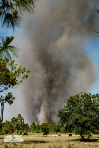
Fire in Grant, Florida, on May 13, 2008.
Fire and rain: The post-chase melancholy has set in, especially since it looks like there will be major severe weather in the Plains later this week, and I won’t be there. We finally had a little rain here in central Florida this weekend after the conflagration of the previous week. A lot of people’s lives went up in smoke.
I got to witness first-hand the drama of watching a farm in the path of the flames. There was something terrible and inexorable about the fire, especially when, on that quiet dirt road, the crackle of the flames was so audible and then their bright orange tongues shot through the trees. The long grass was so crunchy underfoot, it seemed it would take little for all of it to burn. Fortunately, a helicopter, some trucks and some good people stopped the advance.
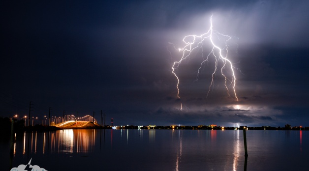
23 MAY 2008 – Lightning flashes over Rockledge, Florida.
Love that lightning: It doesn’t compare to the freakin’ tornado wedgefest in the Plains this week, which work commitments kept me from chasing, but at least there was some nice lightning here in Florida on May 23. At first, Cheryl Chang and I checked out the storms. Then I stuck around a parking lot while the last one came through close to midnight, and I snapped lightning photos in Rockledge. Hope we get lots more picturesque storms this summer.
A storm near Claremore, Oklahoma, on June 6.
Whirlwind trip: I couldn’t resist one more chance to chase tornadoes in the Plains, so after some frustrating flight cancellations, I managed to get out there the morning of June 5, when the Storm Prediction Center was issuing a high risk and anticipating a possible tornado outbreak. I’d also anticipated a day like that, which is why I came out in the first place, but the outbreak didn’t materialize. Even local newspapers had headlines that said the “dire forecast” didn’t come about.
I drove from Kansas City into Nebraska and back to Kansas anyway and caught a beautiful shelf cloud.
Sunset lit up the storms.
The trip was worth it. I saw some wonderful storms anyway, especially the following two days, while chasing with Dave Lewison and Scott McPartland.
On June 7, west of Beatrice, Nebraska, we checked out the distant anvils from a line of storms forming to the west. A line was undesirable, but we hoped one cell would break out and dominate. We checked out multiple storms, finally aiming for a cell in Kansas near Osborne. It had a beautiful curvature indicating rotation, funnels, and eventually, a slender tornado. Here are the photos from this mini chase. Click on any one to start a slide show with captions.
Once I got home to Florida, I caught several lightning storms and even helped cover Tropical Storm Fay for my newspaper. Below are a few more photos from these events. Click on any one to start a slide show with captions.
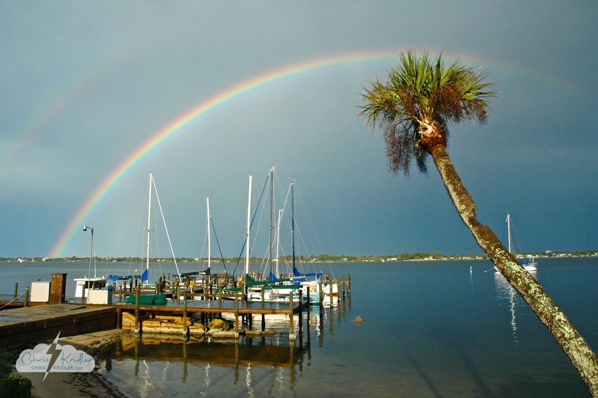
Rainbow in Rockledge, Feb. 13, 2007.
I have extensive archives from my early storm chasing years and am consolidating them and moving them over to ChrisKridler.com from the old SkyDiary. In this instance, while there were some very nice Florida chases in 2007, I’m putting them into this one post with the highlights in a gallery.
Click on any photo to start a slide show of larger images with captions.
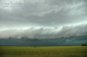
Line of storms near Abilene, Texas, on May 8, 2007.
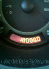
The 2003 Element hit 100,000 miles on May 3, 2007.
I have extensive archives from my early storm chasing years. I chronicled almost every day on the road, even bust days, at the old SkyDiary site, with lots of photos. In the interest of collecting everything in one place, I’m moving the highlights of the older chases and journals over to ChrisKridler.com with select photos to accompany them.
We missed the Oklahoma tornadoes and saw this in the distance en route – would we have seen the Greensburg tornado if we’d pursued these cells? Maybe not, since it hit in the night.
Epic quest: A beast is stalking Kansas tonight. In the morning, we’ll see horrendous footage of damage and hear terrible tales of injuries or worse in Greensburg. I didn’t see the tornado, though it hit in my general target area for the day. The thing is, it hit at or after dark, and I had already moved on to a storm I could actually see before sunset. (Ironically, I think I saw the genesis of the storm when it was a paltry split from an earlier cell, north of the one my friends and I went to see.)
I happened to meet up with Mike Theiss and Brad Riley for the chase at my initial target, Pratt, Kansas, just down the road from Greensburg. And hearing of tornadoes in Oklahoma, we went that way for a bit before it got dark, then gave up the chase before the monster Greensburg tornado occurred. It’s probably better that I didn’t try to chase it at night, but part of me wishes I’d been on that cell.
Sunset storm.
Several chasers apparently stuck with the Greensburg cell, a dangerous thing to do at night, hence the image on KOTV’s Web page. There are amazing reports of 60 percent or more of Greensburg being destroyed and of a damage path that could be a couple of miles wide. There’s a tremendous radar hook on the storm, which put down at least a wedge with a rope satellite, according to storm reports. At least so far, there haven’t been a lot of tornadoes today.
All in all, it probably was a chase not worth 34 hours of almost constant driving from Florida through a full chase day, with 1.5 hours of naps. And I certainly didn’t drive that marathon to watch nice little towns be destroyed. Like other storm chasers, I always hope that if there’s a tornado, it occurs in an abandoned field. The reports are eerie, though, and reminiscent of a fictional scenario in my yet-to-be published novel about storm chasers.
Happy with a little: This was another crazy chase day. I was chasing for, I think, about 12 hours. TWELVE. Usually, the real chase starts in mid- to late afternoon and ends at dark, but the Storm Prediction Center’s high risk Armageddon forecast and the anticipated speed of the storms made me seek to get into position early. Jim Leonard’s advice was to go west, not north, and I started at Buffalo, Oklahoma, which I drove through about twenty times today. I followed one of the very first storms of the day up into Kansas, but the early storms bunched together and weren’t much to write home about, so I decided to go back south to the dryline.
Storm with wall cloud.
I was rewarded with photogenic storm after storm, but the stupid things were all speeding north at 45 mph in an area with few roads. More than once, I gave up pursuit, and they tornadoed among chaser traffic jams in Kansas. I saw a little funnel (shear funnel, I think) on one, and it later produced tornadoes in Kansas. Other tornadoes were reported today, but you really had to be in the right place at the right time.
I thought I had my storm when a gorgeous thing south of Buffalo produced a big rotating wall cloud. It didn’t produce, but it sooo wanted to. A couple of chasers got amazing video of a tornado crossing I-40 and later hitting Sweetwater, way south of where I was. Wow. I was a little down after seeing that, because I had considered zooming down to I-40 and taking my chances. But today was all chances. Though there were tons of storms, they were not easy to catch unless you were ahead of them.
Then, as it got dark, storms started dropping big wedge tornadoes, again, terrorizing residents who had Greensburg on their minds. I just tried to stay out of the way at that point. I’m still baffled by chasers who go after this stuff at night, but maybe they have the radar in their cars. I haven’t spent the big bucks for that yet, so I did my whole chase today with nothing but weather radio to keep me informed (bravo, National Weather Service). Considering the circumstances, I was pretty pleased with that storm with the wall cloud, and I got a lot of other photos I think will come out very nicely of various storms. I’ll post them later – again, I’m too tired. It’s 1 a.m. in Enid, Oklahoma, technically May 6, no matter what the date above says.
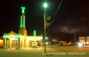
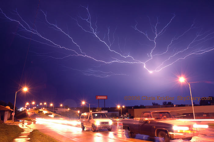
Faint lightning pops behind the U Drop Inn in Shamrock, Texas, May 6, 2007.
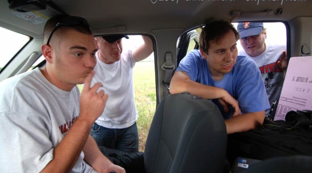
Waiting: This feels more like a chase day – I’m waiting around with friends in Aspermont, Texas, waiting to see where to go to chase a marginal chance of decent storms today. In one car are Dave Lewison and Scott McPartland; in another, Mike Theiss and Brad Riley. We were thinking west. Now maybe a little east. Right now, we’re checking satellite and surface observations and waiting. The last few days have been nothing but driving, it seems, so I welcome a break. Yesterday, May 6, was a line chase, as cells merged and produced photogenic but not very powerful storms, at least in southwest Oklahoma.
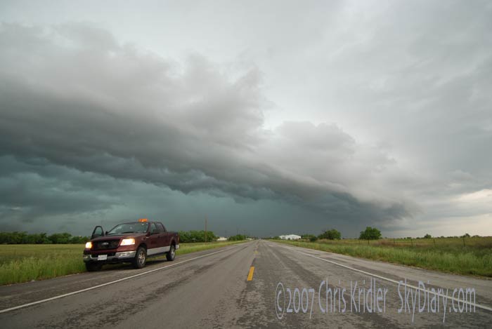
Squall line in Texas.
Car wash: We chased a squall line Tuesday, May 8, or it chased us. It was messy but kinda pretty. The rain was incredibly intense. An isolated storm would be nice. With the computer models the way they are, forecasting a shutdown of stormy weather, this chase could easily end with a whimper. I’ll have to see how today goes.
Rotation: I’ve ended what I hope is only the first phase of my Tornado Alley chase. I feel as if I have unfinished business, because even though the trip wrapped up with a nice, rotating, tornado-warned supercell in Texas, I didn’t see the tornado I wanted to see on this trip.
I still saw some good storms, and compared with the non-action of 2006, it was great – just not ultimately satisfying. I love being in the Plains, anyway. It’s beautiful country, and the towns have so much character. The freedom of driving from place to place, following the weather, is unparalleled. I would like to live a life like that every day. Maybe I need to buy more lottery tickets.
Today’s the anniversary of two big chase events: the Attica tornadoes of 2004 and the South Plains/Lone Star tornado/monster hail event of 2005. This year, I spent the big day napping with the dogs and going to dinner with my husband back in Florida, because my chase is on hold.
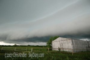
Shelf cloud on May 9.
May 9 was the last chase day. It started in Abilene, like the day before, only this time, I waited around with my friends for what we hoped was an isolated storm. When a shower formed in front of the line and strengthened, we headed off and punched through it. Our group saw a skinny funnel as we came out the other side, and then we saw persistent rotation and wall clouds. The rotation and the storm’s movement were slow; the latter was a relief after the speed-demon storms of the weekend. And the rotation was enough to inspire a warning.
A tornado report followed as the storm neared Throckmorton, but our eyes were glued on this thing at the time, and none of us saw contact with the ground, despite ominous features. I’d like to see photographic evidence of the alleged tornado.
Our group got a bit separated, but we all chose to stair-step northeast on a farm road that started paved and soon became gravelly pudding. It’s a miracle the Element made it through, and there were some unwelcome thrills on the way. After that, I was glad to stay on paved roads ahead of the storm. It looked linear again, and then, as it approached Wichita Falls, appeared to have new rotation. Amazing. There was a pronounced inflow tail and beautiful structure, but it just wasn’t going to do it. As darkness fell, it washed over town and started the process of washing the red Texas mud off my car.
Goodbye, Tornado Alley.
I have extensive archives from my early storm chasing years. I chronicled almost every day on the road, even bust days, at the old SkyDiary site, with lots of photos. In the interest of collecting everything in one place, I’m moving the highlights of the older chases over to ChrisKridler.com. 2006 was one of the worst chasing years in pursuit of storms, thanks to a crashing cold front, but it had a few moments.
8 May 2006
Chase time: Just a quick update. After a 21-hour drive, I’m in Broken Arrow, Okla., and not quite in position to chase today. I’ll need to do my forecast and drive some more to get there, wherever there is, but at least I feel like I’m back in Tornado Alley again. I love what one sees on the road: two billboards next to one another, one warning of fire danger, the other covered with flames advertising a barbecue joint. A sign that says “Watch for long logs” (insert your own joke here). Another for Toad Suck Park in Arkansas. Watermelons galore sold out of the backs of pickup trucks in Mississippi.
Update: I tried but didn’t see much today. Storms didn’t fire where people thought they should, though a big line of them formed in western Kansas, and I got a look. There were some pretty moments and a few good lightning bolts. It’s something and was a good shakedown cruise for gear, including the new ham radio. I’ve now met up with Scott McPartland, Dave Lewison, Pete Ventre and Jim Edds. Given a promised early start in the morning, I anticipate more sleep deprivation in my future. Now we’re at a terrible Days Inn in Great Bend that promised wi-fi, and it’s not working. My ceiling is leaking in the rain. And goodness knows if there really will be a promised hot waffle in the a.m. More later…
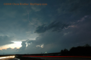
Lightning in McAlester, Oklahoma, May 9, 2006.
9 May 2006
The soggy and the sublime: After an unfulfilling chase yesterday, the hotel nightmare (even the advertised “hot waffle” was not the fresh-made thing you get at some hotels; it was a Kellogg’s toaster product), and continuing sleep deprivation, a chase finally was in the offing today. It provided some adrenaline and some pretty pictures, and that’s about all I can ask for.
Our party left Great Bend, Kansas, fairly early and headed south, checking data now and again to help us pick our target. The obvious choice was southeastern Oklahoma and the less obvious choice was north-west-central Texas. Finally, we settled on eastern OK. As half our party broke off north of Ada to say hi to Cloud 9 Tours, Jim Edds and I proceeded south and then east after getting a look at the towers going up in earnest on the boundary. It was imperative to get east, ahead of the line, or else it would be a day of core-punching. Not that we avoided cores entirely.
Mammatus and lightning in Oklahoma May 9.
In McAlester, we waffled (again with the waffles!) about which storm to pick. A tornado warning was given for the storm to the south, but ours still looked good. We were about to give up on it when it became tornado warned, too. Then, on the west side of town, we spotted what appeared to be a rotating wall cloud. For a moment, I was wondering if we were about to have a tornado form over our heads. Then winds picked up like crazy and we thought we’d try to get east of it. Bad idea, or at least a bad road choice, not that there are any good roads out here in the tree-heavy hills. We got caught in serious horizontal winds — I’d guess about 70mph — with flying debris, driving rain, very low visibility and hail. The core, in other words.
After more storm maneuvering and finding we’d be in the path of another tornado-warned storm, we slipped west back into town and got some very cool lightning shots, Jim with his HD video, me with some video and a lot of stills. This good photo opportunity did a lot to make the day memorable. Now our party is back together, along with Dave Patrick and Kristy Randall, and Mark Robinson and his friend Brian. I’ve spent a lot of time in McAlester today. The problem for tomorrow is that the risk area is in more bad chase territory and way farther east than I prefer to go. Meanwhile, after that, the Plains may be shut down in terms of severe weather. Should I stay or should I go?
11 May 2006
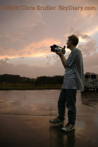
Mark Robinson films a storm May 10 as the season screeches to a halt.
The end already? I’m way behind on updates because of the lack of high-speed Internet and all the driving, which equals no time. We’re in Mississippi, for goodness’ sake. That’s not where we’re supposed to be to chase “Tornado Alley” storms.
We had a good target yesterday but were behind the game all day due to the long distances involved. We got wet and saw some lightning, that’s about it.
I’m actually giving it up for now and hope to come back to the Alley at some later date.
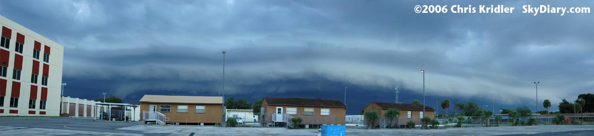
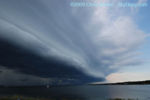
Shelf cloud in Rockledge, Florida, Sept. 2, 2006.
2 September 2006
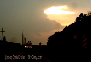
A dramatic shelf cloud formed from a line of storms in Brevard County, Florida, on September 2. First, the pileus cap on top of the storm tower glowed in rainbow colors as the sun caught it from behind. Then the shelf appeared. Here’s a stitched-together panorama of several images of the shelf cloud as seen from Rockledge, Florida.
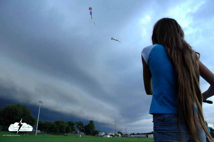
Kids fly kites before the storm, Sept. 2, 2006.
A couple of neighborhood kids were flying kites at the high school ahead of the storm. This is not recommended behavior in a lightning storm, but it was kind of beautiful.


