I’m a year behind the times, but thanks to GalleyCat’s list of Moby Award-winning book trailers, I just saw the one for Sloane Crosley’s “How Did You Get This Number?” You’d never guess it’s for a book, or a book of essays, if it didn’t ultimately tell you, but who cares? It’s a wonderful piece of animation that makes you want to watch it until the end. I made my first book trailer last year for Susan Hubbard’s Ethical Vampire novel “The Season of Risks” and would love to make more. I’ve got to play with animation! Check out the Crosley trailer:
Meanwhile… I just got back from The Hukilau, the tiki festival held in Fort Lauderdale. I shot a lot of video with my Nikon D7000, trying to learn its mysterious ways. One, I’ve learned, even with the external mic, it’s hard to get good sound when bands are playing at deafening levels; and two, the autofocus is pretty awful for video. Unfortunately, it’s hard to see that on the screen in the middle of the action. It’s best to use a tripod, and the camera works best in situations where you can take your time and set up your shot. Of course, reality isn’t always accommodating. Fortunately I also have HD video cameras that are great for action.
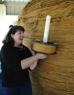
I also took a few stills. This is one of my friend Kathryn at the Mai Kai Polynesian restaurant in Fort Lauderdale. It was just one of those moments when the light was right, and she looked wonderful, and I had to take a photo. Do you agree?

A contemplative moment at the Mai Kai, featuring my friend Kathryn. Photo by Chris Kridler, chriskridler.com
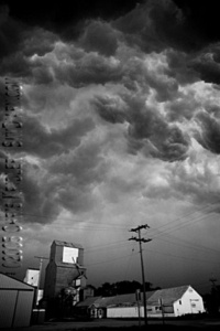
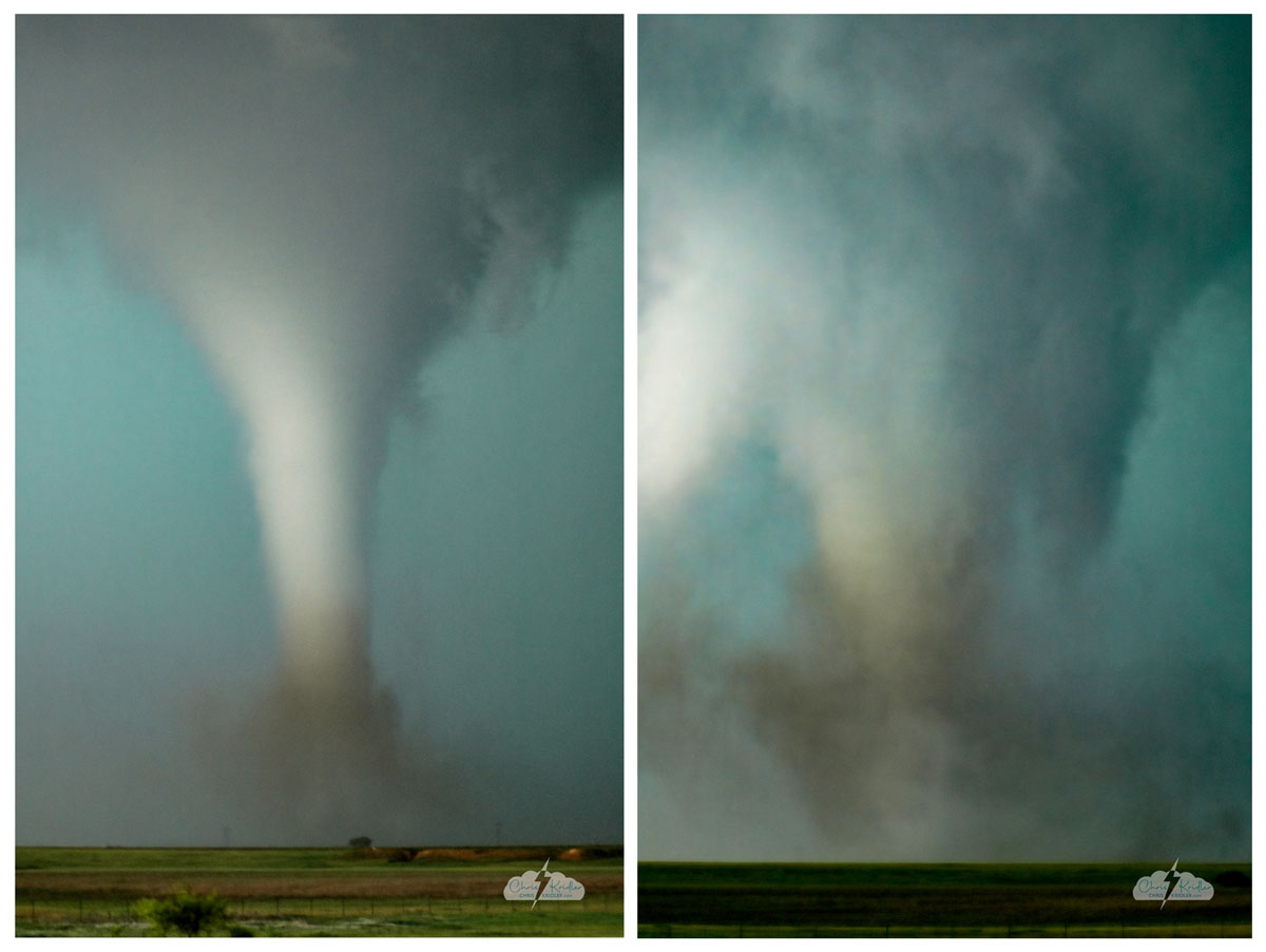
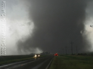
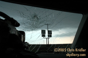
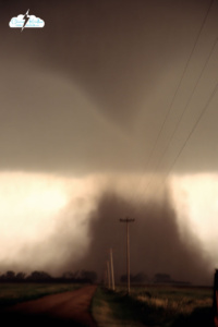
 May 6: Colby, Kansas
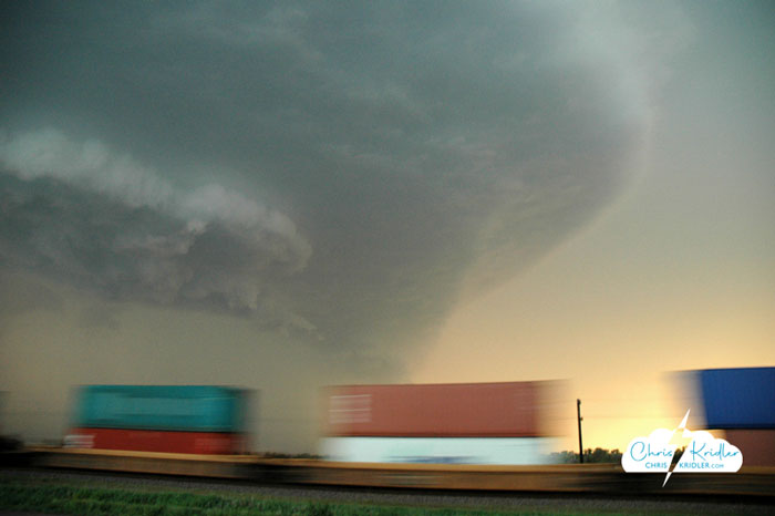
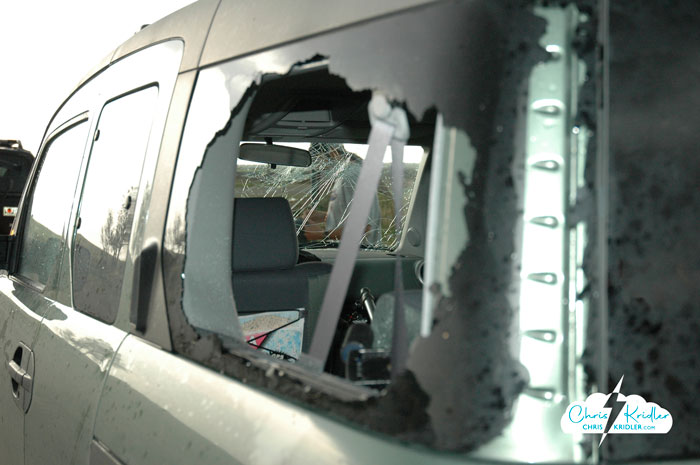
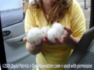
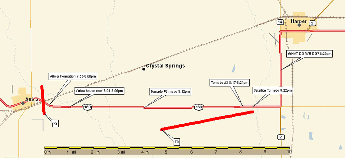
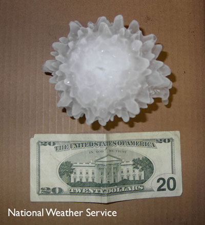 Our priority became getting out of the path. We also had to navigate out of the hail, so we headed east out of Harper. Check out this NWS photo of 5.24-inch hail from this storm!