Chris Kridler
Chris Kridler is a writer, photographer and storm chaser and author of the Storm Seekers Series of storm-chasing adventures.

Chris Kridler is a writer, photographer and storm chaser and author of the Storm Seekers Series of storm-chasing adventures.
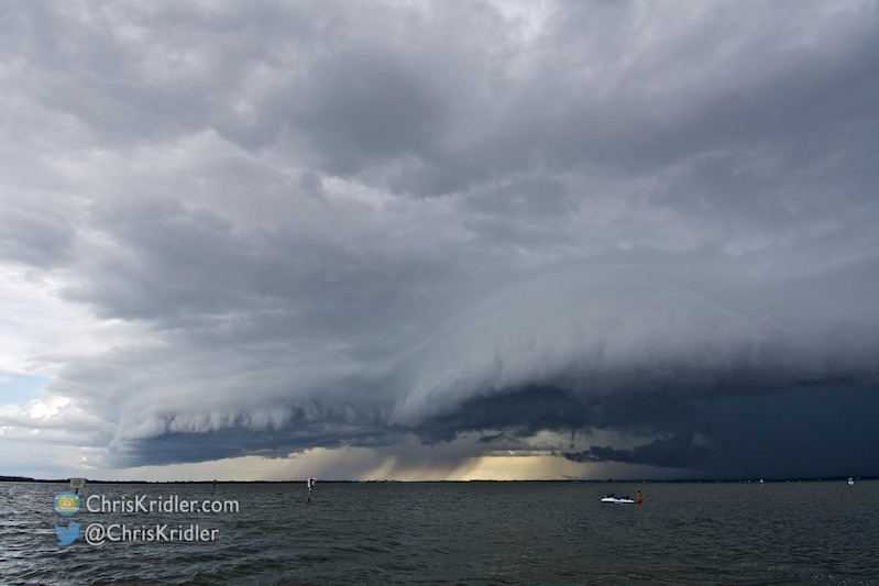
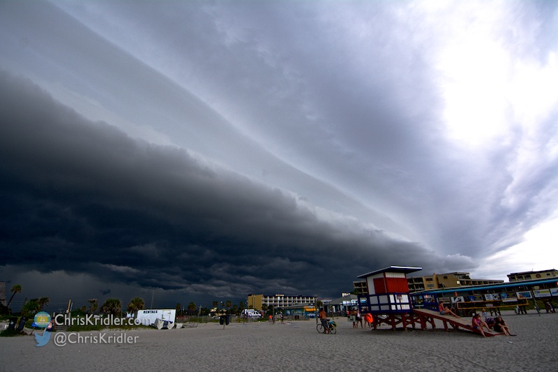
Over the Banana River Lagoon at Cocoa Beach, the shelf cloud was scalloped. This was at 5:18 p.m.
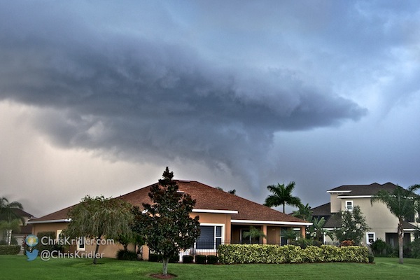
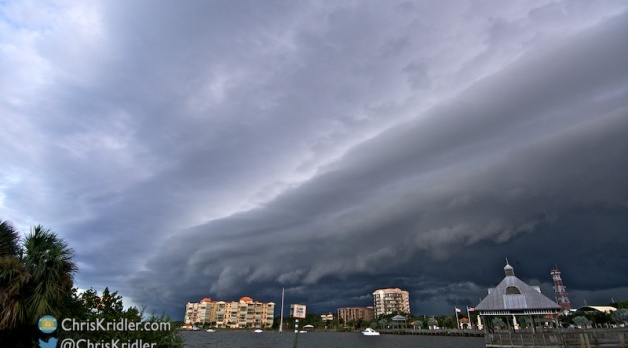
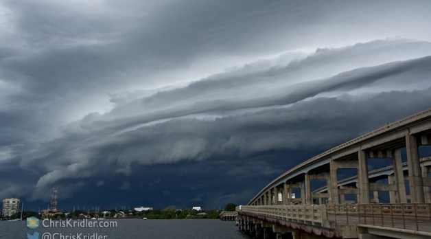
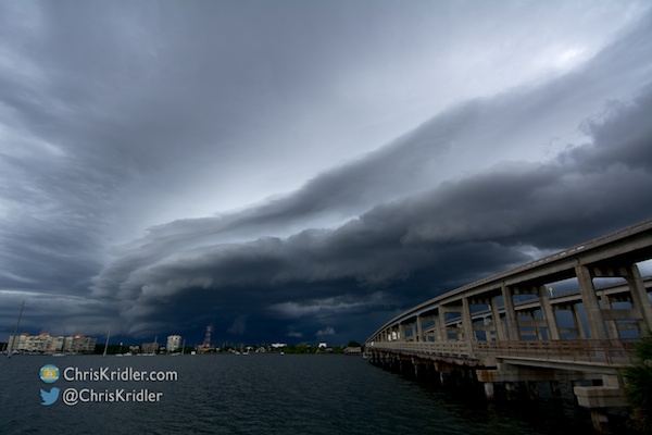
Storms in Brevard County, Florida, on August 9 grew strong quickly, forming scalloped shelf clouds and dumping prodigious amounts of rain.
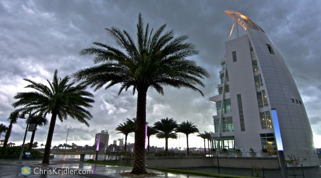
Rain forced me to cancel a portrait shoot, so I dashed across the Indian River Lagoon and shot the storm coming in over Cocoa, Florida, at 5:02 p.m.
I got ahead of the storms by rushing to Merritt Island and shooting back east at Cocoa, then continuing east to Cocoa Beach and ultimately Port Canaveral.
Roll over a photo to see its caption, and click on any of the pictures to start a slide show of larger images.
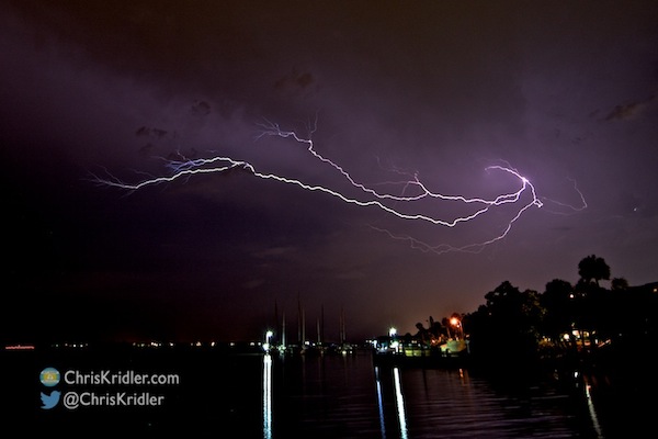
The last gasp of lightning on July 24, as seen looking south from Rockledge, Florida. Photo by Chris Kridler, ChrisKridler.com, SkyDiary.com
One of the reasons I moved to Florida in 1999 was to enjoy the lightning storms. I was living in the mid-Atlantic and had gotten into chasing storms in Tornado Alley two years earlier. I looked into moving to Oklahoma, but career and geography conspired to bring me to Florida. The one thing I didn’t realize was that so few of the lightning storms in the Sunshine State are at night. Most happen during the day. And getting to a storm an hour away in Florida is not nearly as easy as getting to one in Tornado Alley. Why? It’s not just because of the traffic and road network. It’s because Florida storms tend to be short-lived; by the time you hit the road to catch that storm 45 miles away, it’s faded to a misty memory.
A shelf cloud as shot from Cocoa, Florida, on July 25, 2014. Photo by Chris Kridler, ChrisKridler.com, SkyDiary.com
Meanwhile, I’ve been working late on revisions and editing of “Zap Bang,” the final novel in the Storm Seekers trilogy. I’m thrilled to be wrapping up the story and heartbroken to be leaving these characters. It’s coming very soon!
This funnel cloud formed in Viera on July 26. Photo by Chris Kridler, ChrisKridler.com, SkyDiary.com
A note for e-mail subscribers: I am phasing out the Feedburner e-mail service, since Google no longer supports it and I can no longer access it. Please use the link to the right on my site to sign up for the new e-mail list; if you get two copies, please unsubscribe from the Feedburner e-mail. I’m sorry for the inconvenience, but I’m at the mercy of the vagaries of the mega-corporation.
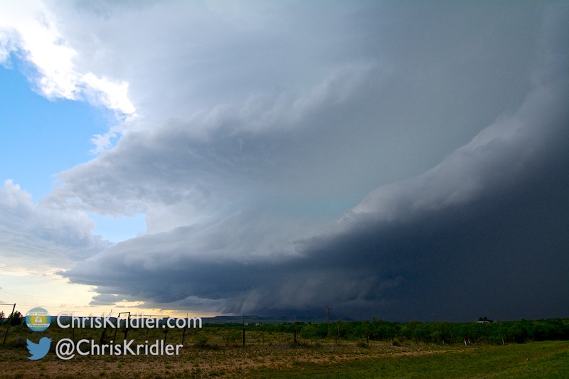
Nice striations in the shelf cloud.
A line of storms formed in east-central Florida on July 14, pushing out an outflow boundary that created a beautiful striated shelf cloud.
I shot photos of it over Cocoa Village, in downtown Cocoa, and then raced east to catch it again at the Cocoa Beach Pier.
Roll over a photo to see its caption, and click on any of the pictures to start a slide show of larger images.
I really liked the look of the shelf cloud as it passed over Cocoa, Florida, and the Indian River Lagoon. Photo by Chris Kridler, ChrisKridler.com
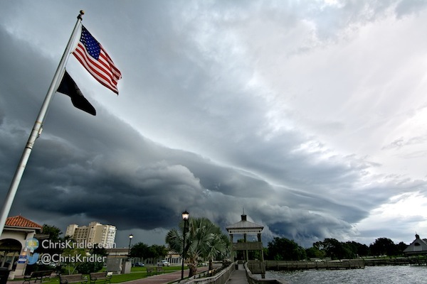
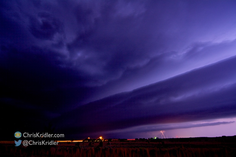
Nature paralleled the unnatural on Wednesday, July 9, 2014, when a beautiful striated shelf cloud moved over Cocoa, Florida, the Indian River Lagoon and the bridge over the S.R. 520 Causeway. It originated from a barely-moving severe storm farther west that sent out an outflow boundary. The shelf cloud almost mirrored the curve of the bridge as it went overhead. This was a “gentle(wo)man’s chase,” just a few miles from home, as I followed the slow-moving line of severe storms.
Roll over a photo to see its caption, and click on any of the pictures to start a slide show of larger images.
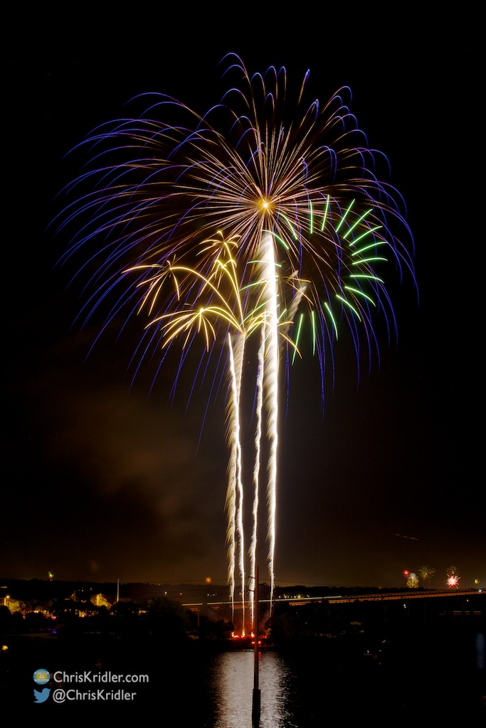
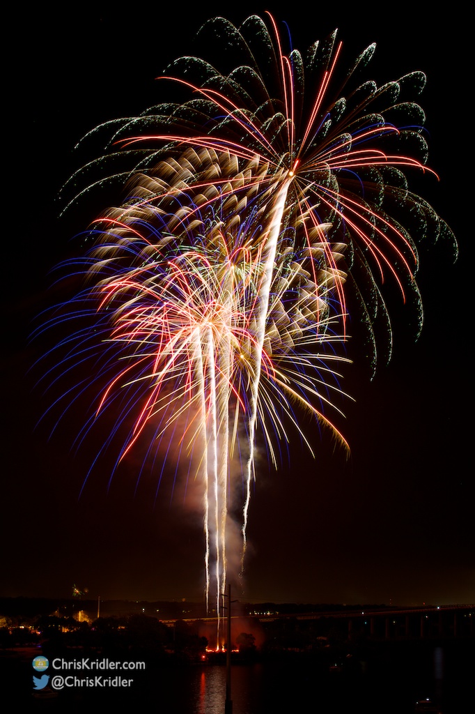
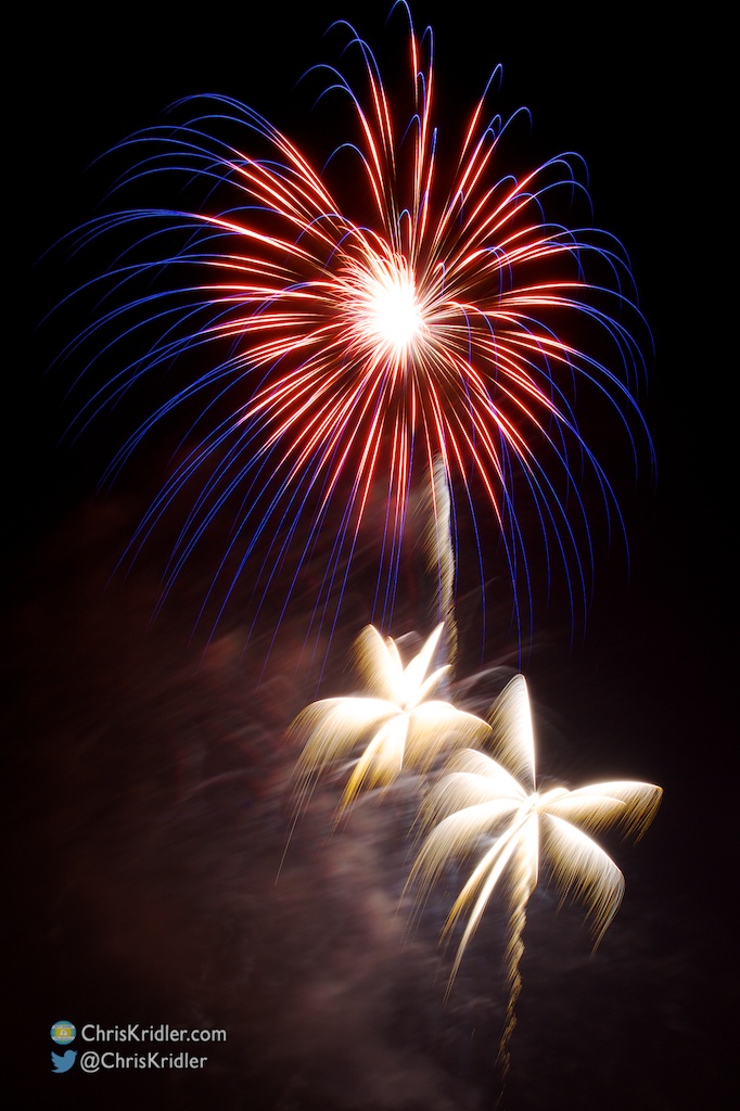
I had a chance to see Cocoa, Florida’s July 4th fireworks from a height on Friday and snapped several photos. They were taken looking toward the S.R. 520 bridge over the Indian River Lagoon. Here are a few of the more interesting explosions. Happy summer!
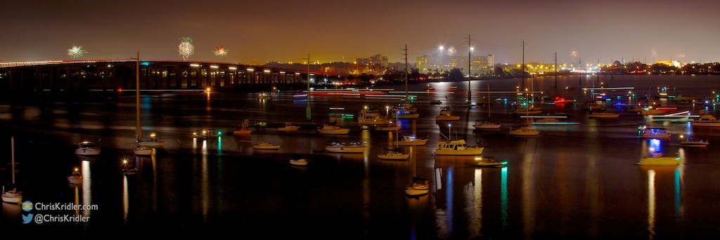
Boats start to move out after Cocoa, Florida’s fireworks on July 4, 2014, as more explosions fire on the horizon. Photo by Chris Kridler, ChrisKridler.com
Off and on for a few years, I’ve been trying to perfect a time-lapse of a night-blooming cereus flowering, but it’s a challenge, because each bloom flowers for only one night. Each time I’ve used a different camera and different lighting. I’ve blown out the image with too much light, so this year I used a smaller light. But I had to use a wide-angle waterproof camera because it was raining in our part of central Florida, so sacrifices were made in terms of quality and zoom. You can see the flowers buffeted by the wind as a shower whisks through.
Still, it’s always fascinating to see these beautiful flowers unfold for their one-night-a-year show. Click the gear symbol in the lower left after you hit play and choose 720HD for best quality.
Here’s the shelf cloud as it appeared to the southwest.
On June 5, 2014, I started my day in Scottsbluff, Nebraska, and decided to target southeast Colorado. This would be my last day of chasing in Tornado Alley for this season.
I made a stop in Limon, running into Charles Edwards of Cloud 9 Tours, and evaluated data before committing to the target. The first storm I chased was near the southernmost town in Colorado, Branson.
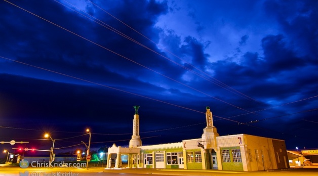
The severe storms led me into the dramatic topography of northeastern New Mexico and then the Texas Panhandle, when lightning lured me to pause during my all-night drive, as I was starting my trip home to the east coast.
I was especially delighted to get shots of a storm looming over the Route 66 landmark U Drop Inn in Shamrock, Texas. The beautiful wee-hours storms were a satisfying way to end a trip of meager setups and an insane amount of driving.
Roll over a photo to see its caption, and click on any of the pictures to start a slide show of larger images.
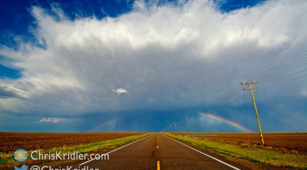
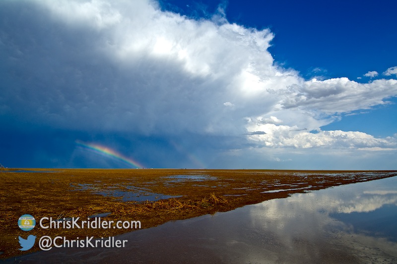
We watched the line overtake us, then shot this rainbow west of Healy.
We faced a bunch of ongoing convection, including a morning storm over Sidney, Nebraska, where we’d spent the night, and knew the forecast would be messy. We chased storms in northwest Kansas, but they had trouble remaining isolated and maintaining their strength.
Still, the skies were sometimes spectacular, and I got a few photos that made me happy.
Roll over a photo to see its caption, and click on any of the pictures to start a slide show of larger images.
On May 26, 2014, Peggy Willenberg and I hopped east to Stanton, Texas, from our starting point in Midland to keep an eye on developing storms.
We ran into friends there, including Dave Lewison, Scott McPartland, Robert Balogh, John Mann, Anemometer Steve Barabas, and The Weather Network’s Mark Robinson, Jaclyn Whittal and Michel Millaire, whom we met on and off all day.
What a swoosh in this storm!
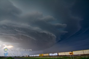
We targeted a storm to the northwest and chased it for a while, then switched to a storm developing behind it. It was a day of stunning structure and rotating features, some of them dusty, and while many of these spinups were reported as tornadoes, we didn’t see any tornado I’d hang on the wall of fame.
Roll over a photo to see its caption, and click on any of the pictures to start a slide show of larger images.
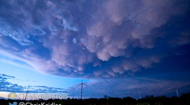
This Nebraska supercell had a mothership appearance and big hail on May 19, 2014. Photo by Chris Kridler, SkyDiary.com, ChrisKridler.com
Catch up on all the chases on my 2014 storm reports page on SkyDiary.com. More updates are in the works. You can see where I am during active storm chases on the map on the tracking page. And please follow me on Twitter for the latest!


