
Severe storms two days in a row. With hail. And tornado warnings. In Florida? And I got to chase them both.
It’s been a weird week for us here in east-central Florida and the Space Coast, but the weather reflects the overall weather pattern, with the southern branch of the jet stream enhancing our chances of severe storms.
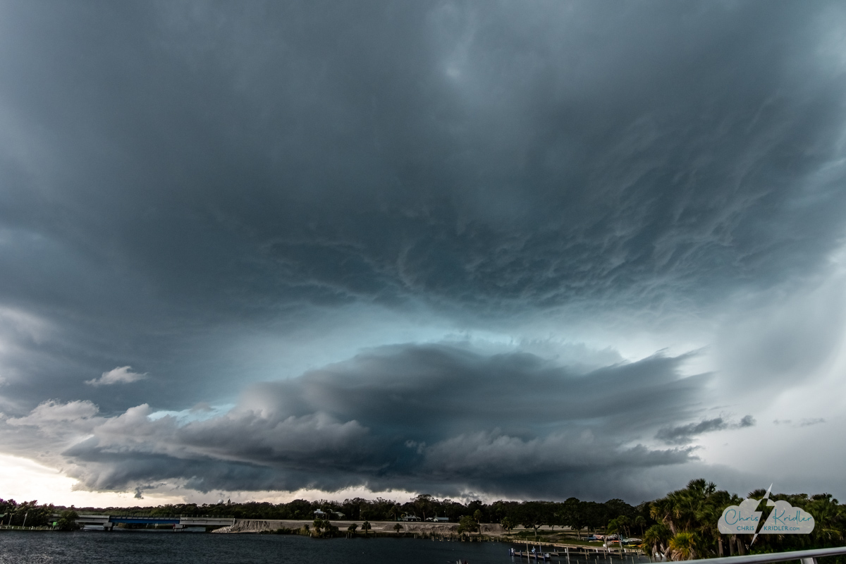
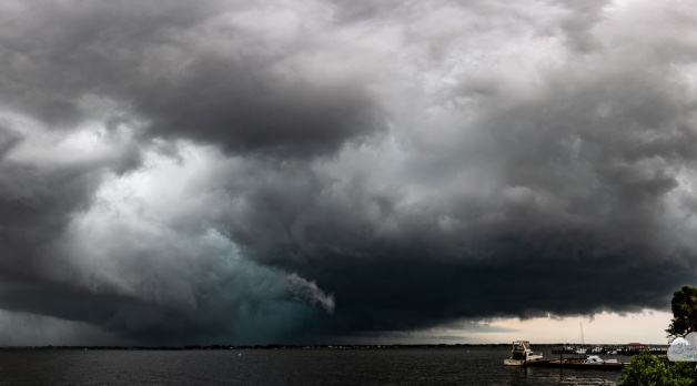
After a ridiculous amount of driving in the rain and horrible traffic, we stopped south of Melbourne at Turkey Creek and got this fantastic view of the supercell, which dumped tons of small hail as it moved south.
We left our viewing spot after reviewing the radar and got on a good-looking storm a bit farther south, following it all the way to Vero Beach through horrible traffic and a lot of rain. Once we got south of it, we were able to get a couple of shots of the pretty structure from a bridge over Turkey Creek in the Palm Bay area. At this time, it was dumping drifts of small hail on parts of Melbourne, but we wanted to stay out of the core in hopes of getting photos.
There weren’t many more opportunities for that, given the territory, but we parked under an overhang in Indian Harbor Shores and waited for the hail to come to us. There was lots of it – but it was all small. Still, it felt like being in a hurricane for a few minutes, and there was lots of minor tree debris and flooding on the road afterward.
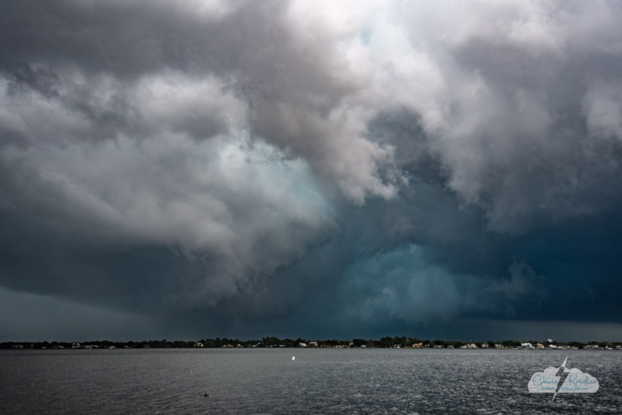
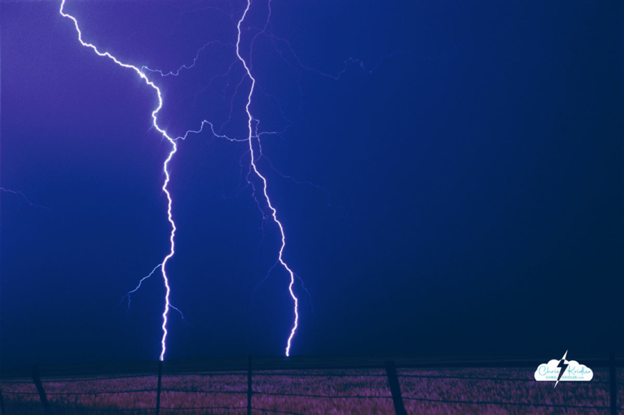
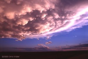
There were many suggestive shapes in the murk as the tornado-warned storm moved east beyond the Indian River Lagoon on April 27.
Tornado-warned storms on Day Two
The next day, April 27, I worked all day, then saw storms headed our way. They seemed promising, so I headed out to the west side of Cocoa near I-95 to take a look. I got into some small hail, then tried to get into position on a tornado-warned storm coming at me without actually getting creamed by said tornado. It was radar-indicated, and while the video shows curvature to the storm amid the deluge, I didn’t see anything tornadic.
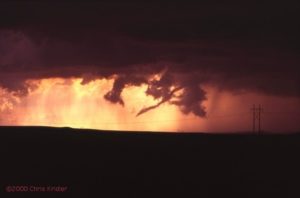
But I dropped slightly south to Rockledge to intercept another storm, and it did a dramatic dance for me before moving east with a tornado warning on it. I hastened to the edge of the Indian River Lagoon and saw what was probably the wildest storm I’ve ever seen in Florida. The structure was fluffy and mushy and tinged with green, presumably from the hail, but a real live rotating wall cloud formed under it. It wasn’t rotating quickly, but it was stunning. Was anything happening in the murk? I wasn’t fully prepared for my “gentleman’s chase” and couldn’t really zoom in well with the lenses I had, but my imagination was working overtime seeing funnels in the gunk.
Check out the video and see what you think.
I’m starting to feel warmed up for Tornado Alley. If you want to keep up with our chases this season, please follow me on Facebook, Instagram, and YouTube. (Alethea’s here on YouTube as well.)
If you like our photos and video, won’t you consider throwing a few bucks into the storm chasing gas fund? Thank you!
Here are photos from both days of chasing. Roll over an image to see the caption, or click on any one to start a slide show.


.")


.")


 Last Thursday, Dave and I targeted northeast Iowa. Low pressure was moving into the area, which would cause the surface winds to come from the south or southeast, while upper-level winds were streaming in from the west. The result: shear in the atmosphere, meaning if a storm went up — and it was likely where the warm and cold fronts met — it would probably rotate.
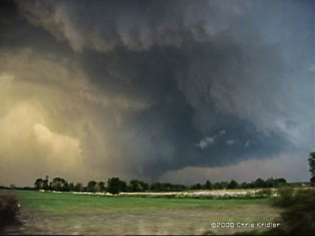
 Going backwards in time to May 16 — the day before — we played what seemed iffy chances for supercells in western Nebraska. We thought the action would be in extreme western Nebraska or even eastern Wyoming, especially after checking data and running into chasers Keith Brown and David Fogel (again in Ogallala). As we zoomed west, it became clear that this was going to be a major chaser convergence. Translated: A circus of idiot drivers. Now, obviously, I don’t think all chasers are irresponsible, but there are definitely chasers who are giving the rest of us a bad name. They are also becoming incredibly ostentatious, with loads of silly equipment on their roofs, including (in my opinion) useless marine radar units. What, are they going boating in their Ford Expeditions?
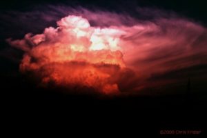 We saw the storm from when it was a pup, a little towering cumulus. It exploded and soon became a big bad dog — isolated. Huge. Multiple overshooting tops. But it was SCREAMING southeast, way ahead of us. It zoomed into Arkansas (Richard left us in mid-chase because of the hopelessness of the pursuit), and we had to listen to hail reports and spotter-reported tornado warning(s) as we tried to pursue it. We ended up in Arkansas, just east of Fort Smith, with a photogenic bomb that formed on its backside — very pretty, though it croaked at sunset. We met David O. Stillings, the Lightning Stalker (that’s just how he introduces himself, too, at rat-a-tat speed) and Jason Persoff, both Florida chasers traveling with a Pioneer Productions TV crew, as well as a couple of Arkansas chasers — Jason Politte and Scott Blair. We’re all part of a strange, little mobile community that keeps meeting on the grassy banks of farm roads in the middle of nowhere.
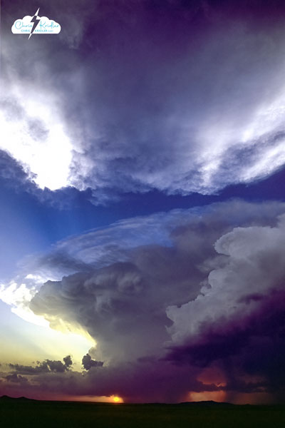
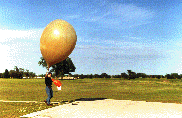 We return to Norman, a southern suburb of OKC, to see the evening launch of a weather balloon at the National Severe Storms Laboratory. Such daily launches provide the lab and its Storm Prediction Center with some of the data needed to predict severe storms.
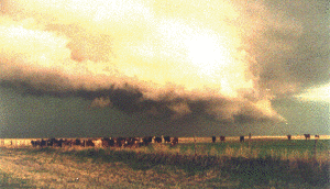 We stop twice in front of what has become a rapidly advancing gust front, a gloomy, undulating line of storm that isn’t likely to produce a tornado but is very likely to spit out hail and rain and fierce winds. It’s on top of us in a just a few minutes each time, sending the cows before it stampeding.
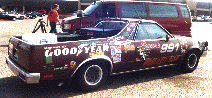 It’s Chaser Convergence, a common phenomenon when serious storm-chasers are after the same storm systems. VORTEX goes through. Matt Biddle’s decal-clad El Camino pulls in, though it appears someone else is driving. Marty Feely appears with one of his Whirlwind Tours. Jim Leonard and Casey Crosbie show up.
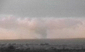 It breaks apart as we stop to watch the advancing storm.
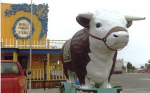 Steve and Charles discuss whether to chase. It’s a “slight risk” day. We decide to give it a shot, but first, a visit to an Amarillo landmark: The Big Texan. A colorful tourist trap, the restaurant-hotel-gift shop complex is designed to look like an Old West town. A elephant-size fake cow guards the front door. A sign tells us that if we can eat a 72-ounce steak in an hour, it’s free!
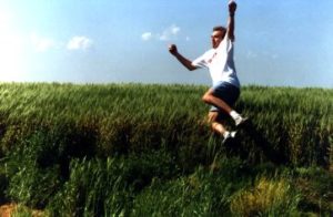 Along a road that looks like Prairie Stop in “North by Northwest,” The Bild reporter tries to melt his ice cream. The Bild photographer snaps pictures. Casey makes phone calls and jumps into a wheat field. Charles plays with his web site and computer games. Steve stares at the sky. Another German journalist, who has joined us for just a couple of days, sits in a dusty gully. I throw a little balsa-wood plane and run to retrieve it, only to screech to a halt in front of an enormous snake. We all gather around. It’s a rattler, all right, but it’s lost its rattle. After some rather foolish teasing by Steve, it slithers off into a wheat field.
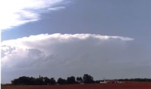 We end up between the storms instead, and they are the most dazzling of the trip. Serendipity guides us. The fabulous sunset sets afire both monster clouds, as rain hangs like feathery mist from their dark bellies. Mammatus clouds glow orange, and lightning forks to the ground and crawls across the sky. A breeze carrying fresh, brisk air whisks through our group. Charles and Lan set up cameras and shout ecstatically when the lightning bolts cooperate with their shutters. I take pictures until I run out of film.
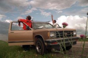 So the next day, Casey takes me and another hanger-on, Allan Rosenberg, storm-chasing. Allan, a lawyer, is the creator of a storm-chasing comic that is only available on the Web.
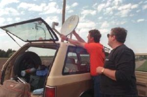 This is how the tour ends, not with a bang, but a whimper. Up into Nebraska we drive, then back down through Kansas, catching some minor storms on the way back to Norman. Charles is frustrated. I’m frustrated. Allan might be frustrated, but he’s not saying.